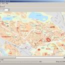
GpsTools Studio 2.3.1 build 227 freeware

... to import a map from a popular image file and to export it to a compatible format. ...

Author Franson Technology
Released 2012-11-21
Filesize 3.80 MB
Downloads 401
OS Windows XP, Windows Vista, Windows Vista x64, Windows 7, Windows 7 x64, Windows 8, Windows 8 x64, Windows 10, Windows 10 x64
Installation Instal And Uninstall
Keywords create map, import GpsGate map, scale image, map, creator, create
Users' rating
(12 rating)
GpsTools StudioCADWindows XP, Windows Vista, Windows Vista x64, Windows 7, Windows 7 x64, Windows 8, Windows 8 x64, Windows 10, Windows 10 x64
GpsTools Studio - file export Freeware Download Notice

GpsTools Studio Free Download - we do not host any GpsTools Studio torrent files or links of GpsTools Studio on rapidshare.com, depositfiles.com, megaupload.com etc. All GpsTools Studio download links are direct GpsTools Studio download from publisher site or their selected mirrors.

GpsTools Studio freeware - The Latest User Reviews
GpsTools Studio freeware - The Latest Versions History
2.3.1 build Nov 21, 2012 New Release

Most popular CAD freeware downloads

FilterPro Desktop

3.1.0.23446 freeware download

... variations; scale passive component values; and view and export filter performance data to Excel. FilterPro ... filters now accounts for passband ripple Supports design file migration from FilterPro v2 so that designs created ...

Digimizer

6.4.0 freeware download

... characteristics. Pictures may be X-rays, micrographs, etc. Supported file formats are JPG, GIF, TIFF, BMP, PNG, WMF, EMF and DICOM files. Images can be rotated, flipped or straightened. ...

QGIS for Mac

3.36.1 freeware download

... formats support by the OGR library · MapInfo files · GRASS integration, including view, edit, and analysis ... raster symbology (grayscale, pseudocolor and multiband RGB) · Export to Mapserver map file · Digitizing support · ...

QFitsView

8.6 freeware download

... analyzing astronomical images, supporting a wide array of file formats including FITS, which is the standard in ... for remote data access and the ability to export images and analysis results in various formats. This ...

Techne CAD/CAM

1.0.31.0 RC freeware download

... type program. Support reference dimension on the drawing. Export or import major CAD file formats. Features: Multithreaded 3D part and ...

GpsTools Studio

2.3.1 build 227 freeware download

... to import a map from a popular image file and to export it to a compatible format. The ...

VEGA ZZ

3.2.3.28 freeware download

... and animation with full support for Accelrys archive file (.arc), AutoDock 4 DLG, BioDock output, CSR (Accelrys ... Vector graphic rendering engine. It's possible to export the view in LaTex, PostScript, Encapsulated PostScript, PDF, ...

SeiSee

2.22.6 freeware download

... analyze the data about earthquakes stored in SEG-Y files. The program can also view the content of CWP, CGG and CST files in order to examine the data.You can use ...

TNTmips

20240404 freeware download

... coordinates from GPS devices ... Import and export an unsurpassed number of raster, geometric, and database file formats; convert between data types; and link to ...

CARIS Easy View

4.2.13 freeware download

... view spatial data imported from numerous types of files. It allows you to load multiple layers, change ... view spatial data from a wide range of file types without the need for specialized software. ...