Engauge Digitizer for Linux 12.0 freeware

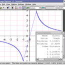
... This open source, digitizing software converts an image file showing a graph or map, into numbers. The image file can come from a scanner, digital camera or ...
The process starts with an image file containing a graph or map. The final result is digitized data that can be used by other tools such as Microsoft Excel. ...

Author Mark Mitchell
Released 2019-08-19
Filesize 10.00 MB
Downloads 777
OS Linux
Installation Instal And Uninstall
Keywords digitize image, image to number, process image, digitize, convert, digitizer
Users' rating
(18 rating)
Engauge Digitizer for LinuxCADLinux
Engauge Digitizer for Linux - file data Freeware Download Notice

Engauge Digitizer for Linux Free Download - we do not host any Engauge Digitizer for Linux torrent files or links of Engauge Digitizer for Linux on rapidshare.com, depositfiles.com, megaupload.com etc. All Engauge Digitizer for Linux download links are direct Engauge Digitizer for Linux download from publisher site or their selected mirrors.

Engauge Digitizer for Linux freeware - The Latest User Reviews
Engauge Digitizer for Linux freeware - The Latest Versions History
12.0 Aug 19, 2019 New Release New hourglass and triangle point types (#346)
Fix data export for log scale data when step factor is less than one (#345)
10.4 Oct 11, 2017 New Release Show warning message when grid line maximum is exceed (#244)
CSV export files have double quotes on fields with internal commas (#243)
Status bar shows all of text for right-to-left languages (#240)
5.1 Dec 24, 2012 New Release Fix for broken point matching, and control of the x/theta axis label.

Most popular CAD freeware downloads

FilterPro Desktop

3.1.0.23446 freeware download

... component values; and view and export filter performance data to Excel. FilterPro active filter design ... filters now accounts for passband ripple Supports design file migration from FilterPro v2 so that designs created ...

SCaVis

2.3 freeware download

SCaVis is an environment for scientific computation, data analysis and data visualization designed for scientists, engineers and students. The ... used everywhere where an analysis of large numerical data volumes, data mining, statistical analysis and mathematics are ...

5 freeware award

QGIS for Mac

3.36.1 freeware download

... Software (FOSS). QGIS supports vector, raster, and database formats and lets you browse and create map data on your computer. QGIS supports many common ...

QFitsView

8.6 freeware download

... is a robust and versatile astronomical imaging and data visualization software that has become an indispensable tool ... Designed to handle the complex demands of astronomical data analysis, DS9 offers a comprehensive suite of features ...

Pro Yacht

1.0.0.1 freeware download

... aid physical modelling. Manipulation of hull section data is rarely supported in modern hull design tools. ... to be adjusted, reducing complexity so that the data can be used for hydrodyamic analysis. For the ...

KMWin

1.52 freeware download

... p-value accuracy Filter Window - Filtering survival time data by applying a filter string, catching filter strings ... are not syntactically correct or filter out all data Preferences Window – Modification of general settings as ...

SeiSee

2.22.6 freeware download

... that need to view and to analyze the data about earthquakes stored in SEG-Y files. The program can also view the content of CWP, CGG and CST files in order to examine the data.You can use ...

TNTatlas

2024 B20240606 freeware download

... you publish and distribute your maps and geospatial data — from a single geodata file to complex map layouts prepared using TNTmips. TNTatlas ... massive sized geodata and will directly display numerous file formats including shapefiles, GeoTIFF, JP2, PNG, MrSID, DXF, ...

Cytoscape for Mac OS X

3.10.0 freeware download

... with annotations, gene expression profiles and other state data. Although Cytoscape was originally designed for biological research, ... distribution provides a basic set of features for data integration and visualization. Additional features are available as ...

TNTatlas for Mac OS X

2024 B20240508 freeware download

... you publish and distribute your maps and geospatial data — from a single geodata file to complex map layouts prepared using TNTmips. TNTatlas ... massive sized geodata and will directly display numerous file formats including shapefiles, GeoTIFF, JP2, PNG, MrSID, DXF, ...