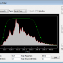
Geogiga Front End 9.0 freeware

Geogiga Front End is designed to QC and preprocess single shot record. You can convert data formats, analyze amplitude decay, correct trigger delay, assign geometry, mute seismic traces, run frequency filter, gain control, vertical stacking, and such. ...

Author Geogiga Technology Corp.
Released 2019-10-02
Filesize 6.02 MB
Downloads 591
OS Windows XP, Windows Vista, Windows Vista x64, Windows 7, Windows 7 x64
Installation Instal And Uninstall
Keywords preprocess seismic data, analyze amplitude decay, correct trigger delay, viewer, editor, correct
Users' rating
(12 rating)
Geogiga Front EndCADWindows XP, Windows Vista, Windows Vista x64, Windows 7, Windows 7 x64
Geogiga Front End - file cut Freeware Download Notice

Geogiga Front End Free Download - we do not host any Geogiga Front End torrent files or links of Geogiga Front End on rapidshare.com, depositfiles.com, megaupload.com etc. All Geogiga Front End download links are direct Geogiga Front End download from publisher site or their selected mirrors.

Geogiga Front End freeware - The Latest User Reviews
Geogiga Front End freeware - The Latest Versions History
9.0 Oct 2, 2019 New Release
8.0 Aug 20, 2015 New Release
7.1 Oct 25, 2012 New Release · Fixed the bugs in reading SEG-D and SEG-Y.

Most popular CAD freeware downloads

QGIS for Mac

3.36.1 freeware download

... formats support by the OGR library · MapInfo files · GRASS integration, including view, edit, and analysis ... and multiband RGB) · Export to Mapserver map file · Digitizing support · Map overview · Plugins ...

VoxelCut

0.4.0 freeware download

... and then lets you call a Python script file called "Run.py" which you can use to add and remove spheres, cuboids, cylinders, etc. You ...

Geogiga Front End

9.0 freeware download

... Undo/Redo multi-step operations on seismic data Resample and cut seismic data Integrate multiple files Support SEG-2, SEG-Y, SEG-D, ASCII, and other data ...

QGIS

3.36.1 freeware download

... formats support by the OGR library · MapInfo files · GRASS integration, including view, edit, and analysis ... and multiband RGB) · Export to Mapserver map file · Digitizing support · Map overview · Plugins ...

QGIS for Linux

3.36.1 freeware download

... formats support by the OGR library · MapInfo files · GRASS integration, including view, edit, and analysis ... and multiband RGB) · Export to Mapserver map file · Digitizing support · Map overview · Plugins ...