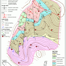
TNTatlas for Mac OS X 2024 B20240508 freeware

... and geospatial data โ€” from a single geodata file to complex map layouts prepared using TNTmips. TNTatlas ... massive sized geodata and will directly display numerous file formats including shapefiles, GeoTIFF, JP2, PNG, MrSID, DXF, and DWG. ...

Author MicroImages, Inc.
Released 2024-05-08
Filesize 87.90 MB
Downloads 763
OS Mac OS X
Installation Instal And Uninstall
Keywords geospatial viewer, view atlas, visualize geospatial data, atlas, map, viewer
Users' rating
(47 rating)
TNTatlas for Mac OS XCADMac OS X
TNTatlas for Mac OS X - file catalog Freeware Download Notice

TNTatlas for Mac OS X Free Download - we do not host any TNTatlas for Mac OS X torrent files or links of TNTatlas for Mac OS X on rapidshare.com, depositfiles.com, megaupload.com etc. All TNTatlas for Mac OS X download links are direct TNTatlas for Mac OS X download from publisher site or their selected mirrors.

TNTatlas for Mac OS X freeware - The Latest User Reviews
TNTatlas for Mac OS X freeware - The Latest Versions History
2024 B202405 May 8, 2024 New Release
2023 B202303 Mar 23, 2023 New Release
2022 B202212 Dec 7, 2022 New Release

Most popular CAD freeware downloads

X-Sweet Home 3D

4.4 [rev18] freeware download

... to the plan from a searchable and extensible catalog organized by categories such as kitchen, living room, ... walls upon it, 3D models to complete default catalog, and textures to customize surfaces ยท Print and ...

TNTatlas for Mac OS X

2024 B20240508 freeware download

... and geospatial data โ€” from a single geodata file to complex map layouts prepared using TNTmips. TNTatlas ... massive sized geodata and will directly display numerous file formats including shapefiles, GeoTIFF, JP2, PNG, MrSID, DXF, ...

TNTatlas

2024 B20240606 freeware download

... and geospatial data โ€” from a single geodata file to complex map layouts prepared using TNTmips. TNTatlas ... massive sized geodata and will directly display numerous file formats including shapefiles, GeoTIFF, JP2, PNG, MrSID, DXF, ...

wxGIS

0.2.0 freeware download

... systems in folders. It also includes a vector file export utility and a tool for correcting the orthographic data from raster TIFF files. ...

wxGIS Portable

0.4.1 freeware download

... systems in folders. It also includes a vector file export utility and a tool for correcting the orthographic data from raster TIFF files. ...