Pro Yacht 1.0.0.1 freeware

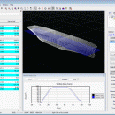
PolyCAD brings together the best selection of hull surface design techniques together within a user interface which allows the extensive manipulation of geometry in 3D dimensions. The software supports the direct manipulation of NURBS surfaces, parametric hull generation and advanced techniques such as IntelliHull and X-Topology. ...

Author Marcus Bole
Released 2012-02-12
Filesize 8.45 MB
Downloads 491
OS Windows 2000, Windows 2003, Windows XP, Windows Vista, Windows 7
Installation Instal And Uninstall
Keywords ship displacement, design ship hull, ship, design, create
Users' rating
(11 rating)
Pro YachtCADWindows 2000, Windows 2003, Windows XP, Windows Vista, Windows 7
Pro Yacht - file analysis Freeware Download Notice

Pro Yacht Free Download - we do not host any Pro Yacht torrent files or links of Pro Yacht on rapidshare.com, depositfiles.com, megaupload.com etc. All Pro Yacht download links are direct Pro Yacht download from publisher site or their selected mirrors.

Pro Yacht freeware - The Latest User Reviews
Pro Yacht freeware - The Latest Versions History
1.0.0.1 Feb 12, 2012 New Release

Most popular CAD freeware downloads

TNTmips

20240404 freeware download

... an unsurpassed number of raster, geometric, and database file formats; convert between data types; and link to ... formats including GeoTIFF, JPEG2000, PNG, MrSID, ECW, shapefile, File Geodatabase, Oracle Spatial, DGN, TAB, DXF, DWG ... ...

QGIS for Linux

3.36.1 freeware download

... formats support by the OGR library · MapInfo files · GRASS integration, including view, edit, and analysis · On the fly projection of vector layers ... and multiband RGB) · Export to Mapserver map file · Digitizing support · Map overview · Plugins ...

Digimizer

6.4.0 freeware download

Digimizer is an easy-to-use and flexible image analysis software package that allows precise manual measurements as ... characteristics. Pictures may be X-rays, micrographs, etc. Supported file formats are JPG, GIF, TIFF, BMP, PNG, WMF, ...

QGIS

3.36.1 freeware download

... formats support by the OGR library · MapInfo files · GRASS integration, including view, edit, and analysis · On the fly projection of vector layers ... and multiband RGB) · Export to Mapserver map file · Digitizing support · Map overview · Plugins ...

OpenRocket

14.06 freeware download

... of components or stages separately Simulation and analysis Full six degree of freedom simulation Rocket ... computed using extended Barrowman method Realistic wind modeling Analysis of the effect of separate components on the ...

DSI Studio

.59 freeware download

... of passing and/or regions of avoidace. · Supported file format for input ROI: text file, Analyze, NIFTI · Supported file format for output tracts: text file, TrackVis .trk ...

Weather Station Data Logger

5.6.0.0 freeware download

... most of the data available on the console, analysis of wind and temperature data plus graphs of ... time. Data is also logged to a CSV file with options for automatic backup and trimming. Daily ...

SCaVis

2.3 freeware download

SCaVis is an environment for scientific computation, data analysis and data visualization designed for scientists, engineers and ... SCaVis can be used everywhere where an analysis of large numerical data volumes, data mining, statistical ...

5 freeware award

QGIS for Mac

3.36.1 freeware download

... formats support by the OGR library · MapInfo files · GRASS integration, including view, edit, and analysis · On the fly projection of vector layers ... and multiband RGB) · Export to Mapserver map file · Digitizing support · Map overview · Plugins ...

VIPER

3.49 B467 freeware download

... mass. It can read MS data from several file formats: .PEK, .CSV (Decon2LS format), .mzXML, and .mzData. See the Readme.txt file installed with VIPER for additional details on the ...