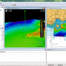
CARIS Easy View 4.2.13 freeware

... of your fly-throughs and save them to AVI files. ...

Author CARIS
Released 2015-08-27
Filesize 106.00 MB
Downloads 465
OS Windows XP, Windows Vista, Windows Vista x64, Windows 7, Windows 7 x64, Windows 8, Windows 8 x64, Windows 10, Windows 10 x64
Installation Instal And Uninstall
Keywords View Spatial Data, View Map, Analyze Map, Map, Model, Surface, Geography
Users' rating
(13 rating)
CARIS Easy ViewCADWindows XP, Windows Vista, Windows Vista x64, Windows 7, Windows 7 x64, Windows 8, Windows 8 x64, Windows 10, Windows 10 x64
CARIS Easy View - file analysis Freeware Download Notice

CARIS Easy View Free Download - we do not host any CARIS Easy View torrent files or links of CARIS Easy View on rapidshare.com, depositfiles.com, megaupload.com etc. All CARIS Easy View download links are direct CARIS Easy View download from publisher site or their selected mirrors.

CARIS Easy View freeware - The Latest User Reviews
CARIS Easy View freeware - The Latest Versions History
4.2.13 Aug 27, 2015 New Release Consistent user experience in 2D and 3D
The properties for coverages have been redesigned and apply both in 2D and 3D. A number of new options are presented including the ability to drape high resolution imagery (e.g. backscatter) over elevations in both 2D and 3D views.
Also, a new user interface is provided to investigate the processing lineage of a dataset recorded in the metadata.
Click to return to top of page
Coordinate reference system enhancements
The coordinate reference system (CRS) functionality has been augmented with EPSG CRS and transformations, such as NTv2. The user interface was upgraded with a new look and with additional capabilities. Users can now build a favourites list, see a list of recently used CRS entries, search for new entries and investigate all aspects of the selected reference system or transformation.
Note that if an incorrect CRS has been selected when opening a dataset in the application, it is now possible to change the CRS in the Properties window wh
4.1.11 Aug 27, 2015 New Release Expanded support for commonly used geospatial data formats (e.g. BAG, GeoTIFF, S-57) and web services (WMS, WCS, WMTS, WTMS).
Upgraded support for non-proprietary BAG format to version 1.5.2, which is the latest
version provided by the Open Navigation Surface Working Group.

Most popular CAD freeware downloads

TNTmips

20240404 freeware download

... an unsurpassed number of raster, geometric, and database file formats; convert between data types; and link to ... formats including GeoTIFF, JPEG2000, PNG, MrSID, ECW, shapefile, File Geodatabase, Oracle Spatial, DGN, TAB, DXF, DWG ... ...

QGIS for Linux

3.36.1 freeware download

... formats support by the OGR library · MapInfo files · GRASS integration, including view, edit, and analysis · On the fly projection of vector layers ... and multiband RGB) · Export to Mapserver map file · Digitizing support · Map overview · Plugins ...

Digimizer

6.4.0 freeware download

Digimizer is an easy-to-use and flexible image analysis software package that allows precise manual measurements as ... characteristics. Pictures may be X-rays, micrographs, etc. Supported file formats are JPG, GIF, TIFF, BMP, PNG, WMF, ...

QGIS

3.36.1 freeware download

... formats support by the OGR library · MapInfo files · GRASS integration, including view, edit, and analysis · On the fly projection of vector layers ... and multiband RGB) · Export to Mapserver map file · Digitizing support · Map overview · Plugins ...

OpenRocket

14.06 freeware download

... of components or stages separately Simulation and analysis Full six degree of freedom simulation Rocket ... computed using extended Barrowman method Realistic wind modeling Analysis of the effect of separate components on the ...

DSI Studio

.59 freeware download

... of passing and/or regions of avoidace. · Supported file format for input ROI: text file, Analyze, NIFTI · Supported file format for output tracts: text file, TrackVis .trk ...

Weather Station Data Logger

5.6.0.0 freeware download

... most of the data available on the console, analysis of wind and temperature data plus graphs of ... time. Data is also logged to a CSV file with options for automatic backup and trimming. Daily ...

SCaVis

2.3 freeware download

SCaVis is an environment for scientific computation, data analysis and data visualization designed for scientists, engineers and ... SCaVis can be used everywhere where an analysis of large numerical data volumes, data mining, statistical ...

5 freeware award

CARIS Easy View

4.2.13 freeware download

... view spatial data imported from numerous types of files. It allows you to load multiple layers, change ... view spatial data from a wide range of file types without the need for specialized software. ...

QGIS for Mac

3.36.1 freeware download

... formats support by the OGR library · MapInfo files · GRASS integration, including view, edit, and analysis · On the fly projection of vector layers ... and multiband RGB) · Export to Mapserver map file · Digitizing support · Map overview · Plugins ...