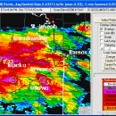
GetNexrad 4.4.2 freeware

GetNexrad 3.5.2 is a tool used to view real-time area radar rainfall loops and to generate the basin point file (NexradPointESX10210.txt) used by GetRealtime.exe for computing the basin area average rainfall time series in real time. ...

Author Carson
Released 2023-08-08
Filesize 10.00 MB
Downloads 535
OS Windows XP, Windows Vista, Windows Vista x64, Windows 7, Windows 7 x64, Windows 8, Windows 8 x64, Windows 10, Windows 10 x64, Windows 11
Installation Instal And Uninstall
Keywords extract rainfall amount, DBZ analysis, view radar rainfall, view, extract, rainfall
Users' rating
(13 rating)
GetNexradCADWindows XP, Windows Vista, Windows Vista x64, Windows 7, Windows 7 x64, Windows 8, Windows 8 x64, Windows 10, Windows 10 x64, Windows 11
GetNexrad - extract images Freeware Download Notice

GetNexrad Free Download - we do not host any GetNexrad torrent files or links of GetNexrad on rapidshare.com, depositfiles.com, megaupload.com etc. All GetNexrad download links are direct GetNexrad download from publisher site or their selected mirrors.

GetNexrad freeware - The Latest User Reviews
GetNexrad freeware - The Latest Versions History
4.4.2 Aug 8, 2023 New Release
4.3.3 Feb 19, 2019 New Release
4.1.5 Mar 8, 2017 New Release

Most popular CAD freeware downloads

p3d

2.6.2 freeware download

... p3d, convert raw data of CCD detectors into extracted spectra that can thereafter be used for scientific ... tasks in IFS data-reduction. p3d can combine several images (exposures) into one image, clean single images of ...

p3d for Linux, Mac OS X

2.2.4.1 freeware download

... p3d, convert raw data of CCD detectors into extracted spectra that can thereafter be used for scientific ... hundred to several thousand. p3d can combine several images (exposures) into one image, can extract spectra using ...

JMARS

3.1.5 freeware download

... single, registered multilayer image. * Make topographic profiles, extract surface temperatures (day or night), plot footprints and render remote sensing images from orbiters. * Correlate mineral compositions with topographic ...

5 freeware award

JMARS for Windows

3.1.5 freeware download

... single, registered multilayer image. * Make topographic profiles, extract surface temperatures (day or night), plot footprints and render remote sensing images from orbiters. * Correlate mineral compositions with topographic ...

GetNexrad

4.4.2 freeware download

... up to the past 4 hours of radar images without using GetRealtime you can, and you (and ... files and 0.5 dBZ long range higher resolution images. Goggle Map overlays, real-time surface observations, and a ...

GeoMapApp

3.7.1 freeware download

... North polar and South polar projections. Save the images for papers and presentations. Users can import their own grids, tabular data, images, and shapefiles. For imported grids, the color palette, ...