Navigation:
- Freeware
- - Graphic Apps
- - CAD
- - GeoMapApp
GeoMapApp 3.7.1 freeware
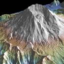
... Thermal Emission and Reflection Radiometer) and NED (National Elevation Dataset) topography datasets for the global land masses. ...
| Author | William Haxby |
| Released | 2023-08-15 |
| Filesize | 78.00 MB |
| Downloads | 201 |
| OS | Windows 2000, Windows 2003, Windows XP, Windows Vista, Windows Vista x64, Windows 7, Windows 7 x64, Windows 8, Windows 8 x64, Windows 10, Windows 10 x64, Windows 11 |
| Installation | Instal And Uninstall |
| Keywords | geological map, geologic exploration, explore map, explore, geologic, map |
| Users' rating (7 rating) |
GeoMapApp Free Download - we do not host any GeoMapApp torrent files or links of GeoMapApp on rapidshare.com, depositfiles.com, megaupload.com etc. All GeoMapApp download links are direct GeoMapApp download from publisher site or their selected mirrors.
| 3.7.1 | Aug 15, 2023 | New Release | Removed commas in saved digitized segment files. Set mask to only be controlled by the mask button, not by the transparency of a grid layer. Fixed issue with contributed grid units. Fixed issue with re-saving an imported saved session. Fixed issue with importing grids that cross the Greenwich Meridian. Fixed issue with importing NetCDF files where the COARDS compliant flag is not in the first line of the Global Attributes. Added logging of data and image downloads and saves. Fixed issue that causes 'illegal reflective access operation' warning messages when using Java 9 or higher. Fixed various issues with Digital and Analog Seismic portals. Fixed broken link on Seafloor Earthquakes and Volcanic Eruptions portal. Updated PetDB Catalog. Updated Grid Composer logic. Updated startup page. Updated Symantec code-signing certificate so Webstart version will now work again. |
| 3.6.10 | Apr 10, 2019 | New Release | Removed commas in saved digitized segment files. Set mask to only be controlled by the mask button, not by the transparency of a grid layer. Fixed issue with contributed grid units. Fixed issue with re-saving an imported saved session. Fixed issue with importing grids that cross the Greenwich Meridian. Fixed issue with importing NetCDF files where the COARDS compliant flag is not in the first line of the Global Attributes. Added logging of data and image downloads and saves. Fixed issue that causes 'illegal reflective access operation' warning messages when using Java 9 or higher. Fixed various issues with Digital and Analog Seismic portals. Fixed broken link on Seafloor Earthquakes and Volcanic Eruptions portal. Updated PetDB Catalog. Updated Grid Composer logic. Updated startup page. Updated Symantec code-signing certificate so Webstart version will now work again. |


