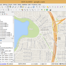
QGIS 3.36.1 freeware

QGIS supports vector, raster, and database formats and lets you browse and create map data on your computer.
QGIS supports many common spatial data formats (e.g. ESRI ShapeFile, geotiff). QGIS supports plugins to do things like display tracks from your GPS.
QGIS aims to be an easy to use GIS, providing common functions and features. The initial goal was to provide a GIS data viewer. ...

Author Gary Sherman
Released 2024-03-26
Filesize 1000.00 MB
Downloads 802
OS Windows XP, Windows Vista, Windows Vista x64, Windows 7, Windows 7 x64, Windows 8, Windows 8 x64, Windows 10, Windows 10 x64, Windows 11
Installation Instal And Uninstall
Keywords geographic information system, map creator, map viewer, GIS, geographic information, create, QGIS
Users' rating
(36 rating)
QGISCADWindows XP, Windows Vista, Windows Vista x64, Windows 7, Windows 7 x64, Windows 8, Windows 8 x64, Windows 10, Windows 10 x64, Windows 11
QGIS - editing t free Freeware Download Notice

QGIS Free Download - we do not host any QGIS torrent files or links of QGIS on rapidshare.com, depositfiles.com, megaupload.com etc. All QGIS download links are direct QGIS download from publisher site or their selected mirrors.

QGIS freeware - The Latest User Reviews
QGIS freeware - The Latest Versions History
3.36.1 Mar 26, 2024 New Release
3.36.2 Apr 25, 2024 New Release
3.36.1 Mar 26, 2024 New Release

Most popular CAD freeware downloads

MeshMagic 3D Modeling Software Free

2.00 freeware download

With MeshMagic 3D, viewing and editing stl files has never been easier. Import STL ... an excellent 3D modeling program for viewing and editing STL files. The interface is intuitive and allows ...

QGIS for Mac

3.36.1 freeware download

... on top of and proud to be itself Free and Open Source Software (FOSS). QGIS supports ... overview · Plugins · Improved vector and attribute editing · Improved measure tools with area measuring · ...

QGIS for Linux

3.36.1 freeware download

... on top of and proud to be itself Free and Open Source Software (FOSS). QGIS supports ... overview · Plugins · Improved vector and attribute editing · Improved measure tools with area measuring · ...

nanoCAD

5.1.2524.2017 freeware download

nanoCAD - easy-to-use free CAD software delivering great user experience by providing ... industry or enterprise. And above all, nanoCAD is free to use and share. nanoCAD has been specifically ...

QGIS

3.36.1 freeware download

... on top of and proud to be itself Free and Open Source Software (FOSS). QGIS supports ... overview · Plugins · Improved vector and attribute editing · Improved measure tools with area measuring · ...

BimRoad

Plus freeware download

... defined connection road. Automatic connection road plan by editing nose point. Automatic correction of road plan design element using parametric method. Free alignment plan and correction using only mouse like ...

GOM Inspect

7.5 SR1 freeware download

GOM Inspect - Powerful, free software for inspection and mesh processing GOM Inspect is a free 3D inspection and mesh processing software for dimensional ... meshes Export as STL, ASCII, ... Free result viewer Full-field measuring data allows for ...

ZWCAD Viewer

2017 freeware download

Free ZWCAD Viewer for CAD DWG File Viewing and ... lighter as it does not include tools for editing models. As the simplified version of ZWCAD, it ...