LanDTM 6.1 freeware

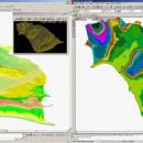
There is not any professional program on internet like this and you can get it without any effort. I think this could be a handicap because it's dificult to believe, but it's true; try it and you'll be surprised. It's not only a program to calculate a delaunay triangulation but you can input break-lines to get a real representation of the terrain. ...

Author Aplicaciones Topográficas S.L.
Released 2017-04-23
Filesize 58.80 MB
Downloads 599
OS Windows XP, Windows Vista, Windows Vista x64, Windows 7, Windows 7 x64, Windows 8, Windows 8 x64, Windows 10, Windows 10 x64
Installation Instal And Uninstall
Keywords Delaunay triangulation, Terrain Representation, CAD addon, Delaunay triangulation, Calculate, Terrain
Users' rating
(9 rating)
LanDTMCADWindows XP, Windows Vista, Windows Vista x64, Windows 7, Windows 7 x64, Windows 8, Windows 8 x64, Windows 10, Windows 10 x64
LanDTM - edit Freeware Download Notice

LanDTM Free Download - we do not host any LanDTM torrent files or links of LanDTM on rapidshare.com, depositfiles.com, megaupload.com etc. All LanDTM download links are direct LanDTM download from publisher site or their selected mirrors.

LanDTM freeware - The Latest User Reviews
LanDTM freeware - The Latest Versions History
6.1 Apr 23, 2017 New Release
6.1.6 Feb 16, 2012 New Release · New installers of the program to 32 and 64 bits platforms.
· LanDTM on BricsCAD v12.
· LanDTM on Autocad 2012.
· Separator/discriminator of points.
· Compatibility with "gsf" grid files REDNAP of Geoid ondulation.
· Elevation modification of PPuntos.
· Importation/exportationn of Points to PPuntos.
· Compatibility between formats. Trimble M3, GPS Trimble, GSI of Stonex.
6.1.5 Oct 5, 2011 New Release · You can digitalize lines and points in Google Earth and export them to the CAD. It Works in BricsCAD v11.

Most popular CAD freeware downloads

FilterPro Desktop

3.1.0.23446 freeware download

... filter design tool allows designers to create and edit active filter designs easily using the Filter Design Wizard. Users can design multiple feedback (MFB), Sallen-Key, ...

Gmsh

4.13.1 freeware download

... add, translate, rotate, scale), physical groups (coherence, reload, edit file), define one, two and three dimensions, as well as run GetDP to solve elements. ...

QGIS for Linux

3.36.1 freeware download

... · MapInfo files · GRASS integration, including view, edit, and analysis · On the fly projection of ... overview · Plugins · Improved vector and attribute editing · Improved measure tools with area measuring · ...

ChaosPro

4.0.249 freeware download

ChaosPro is a real time freeware fractal generator for MS Windows with support for many different fractal types (2D and 3D), true color support, animation support. ...

5 freeware award

TNTmips

20240404 freeware download

... all the tools you need to view, create, edit, georeference, interpret, and publish any type of geospatial data. TNTmips provides professional geospatial tools in a ...

Portable MicroDicom x64

2024.2 freeware download

MicroDicom x64 is application for primary processing and preservation of medical images in DICOM format. It is equipped with most common tools for manipulation of DICOM ...

MicroDicom x64

2024.2 freeware download

MicroDicom x64 is application for primary processing and preservation of medical images in DICOM format. It is equipped with most common tools for manipulation of DICOM ...

JMARS for Windows

3.1.5 freeware download

... process vector data in several common formats. * Edit vector data on the map or in a table. * Use vector processing tools to calculate ...

JMARS

3.1.5 freeware download

... process vector data in several common formats. * Edit vector data on the map or in a table. * Use vector processing tools to calculate ...

5 freeware award

Cirrus Seismic Evaluation

2.5 freeware download

... interface and allows you to view and to edit its parameters. This application also allows you to save the data or to print the ...