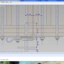
GGCad Free Edition 2.1.0.5 freeware

GGCad includes an advanced user interface. It is made up of windows that can be moved, detached at the user's convenience. The size and icon transparency, the font and the colors can be redefined. Workspaces can be saved and loaded. GGCad includes a complete set of tools. It does support quoting, hatches, images, texts. ...

Author GGSoft
Released 2012-11-26
Filesize 21.20 MB
Downloads 525
OS Windows 2000, Windows 2003, Windows XP, Windows Vista, Windows Vista x64, Windows 7, Windows 7 x64
Installation Instal And Uninstall
Keywords g-code generator, CAD viewer, DXF reader, g-code, CAD, DXF
Users' rating
(15 rating)
GGCad Free EditionCADWindows 2000, Windows 2003, Windows XP, Windows Vista, Windows Vista x64, Windows 7, Windows 7 x64
GGCad Free Edition - dxf Freeware Download Notice

GGCad Free Edition Free Download - we do not host any GGCad Free Edition torrent files or links of GGCad Free Edition on rapidshare.com, depositfiles.com, megaupload.com etc. All GGCad Free Edition download links are direct GGCad Free Edition download from publisher site or their selected mirrors.

GGCad Free Edition freeware - The Latest User Reviews
GGCad Free Edition freeware - The Latest Versions History
2.1.0.5 Nov 26, 2012 New Release · Crash at startup on new installations.
· Problem in importing DXF when levels are grouped into blocks.
· The default model group was no longer responsible.
2.0.8.5 Jun 15, 2012 New Release · Copy/paste of entities between two GGCad application, including between a 2D document and a 3D document for polyline entities.
· Fast plunge mode for 3D tool path in preferences/CAM
· [a] and [m] key shortcuts while [auto] or [manual] buttons are displayed.
2.0.5.3 Jun 15, 2012 New Release · Copy/paste of entities between two GGCad application, including between a 2D document and a 3D document for polyline entities.
· Fast plunge mode for 3D tool path in preferences/CAM
· [a] and [m] key shortcuts while [auto] or [manual] buttons are displayed.

Most popular CAD freeware downloads

TNTatlas for Mac OS X

2024 B20240508 freeware download

... file formats including shapefiles, GeoTIFF, JP2, PNG, MrSID, DXF, and DWG. Geospatial information plays a growing part in the way we work and live. ...

DipTrace Free

4.3.0.0 freeware download

... with other EDA and CAD packages. Output formats: DXF, Gerber, ODB++, Gerber X2, IPC-D-356A, N/C Drill, and G-code. Standard libraries contain over 160,000 components and ...

GstarCAD MC

3.3.1 freeware download

... and edit CAD drawings ( DWG, OCF and DXF files) directly on your mobile device after transferring ... kinds of situation, and fully compatible with DWG, DXF. Various of CAD features such as: Edit, View, ...

GGCad Free Edition

2.1.0.5 freeware download

GGCad includes an advanced user interface. It is made up of windows that can be moved, detached at the user's convenience. The size and icon transparency, ...

VariCAD Viewer for Linux

2024 2.01 freeware download

... convertor and printing software working with 2D DWG, DXF, 3D STEP and 2D/3D VariCAD file formats. VariCAD viewer allows you to convert DWG to DXF and vice-versa, convert STEP to 3D IGES or ...

Ring2D for Windows

1.06 freeware download

... sheet width. Reports are exported in PNG or DXF format. Nesting Engine provides: - Packing rings and disks. - Packing in rectangular sheet and circular ...

ShareCAD

2.0 freeware download

... following formats are supported: CAD formats: AutoCAD DWG, DXF, DWF, HPGL, PLT; Vector formats: PDF, SVG, EMF, WMF, CGM; 3D formats: STEP, STP, IGES, IGS, ...

Online CAD Converter

1.5 freeware download

Online CAD Converter is the safest solution to convert CAD, CGM, HPGL, SVG files. Output file types include PDF, TIFF, JPEG, EMF, CGM, HPGL, and SVG. ...

VisualCAM

1.0.5.0 freeware download

VisualART 1.0 requires the VisualCAM 1.0 base platform to be installed. If you have not installed VisualCAM 1.0 please install that first before installing VisualART 1.0. ...

TNTatlas

2024 B20240606 freeware download

... file formats including shapefiles, GeoTIFF, JP2, PNG, MrSID, DXF, and DWG. Geospatial information plays a growing part in the way we work and live. ...