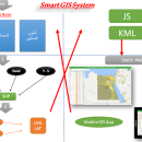
Elshayal Smart 23.02 freeware

... save GPS route and View and Rectify Raster Images gif, jpg, bmp and Edit shape files, build new layer, add existing layer, remove layers, swap layers, save layer, set layer data source, layer properties, zoom in & zoom out, pan, identify, selecting features, invert selection, show data table, data query builder, location query builder, build network. ...

Author Elshayal Smart Web On Line Software
Released 2023-02-28
Filesize 6.00 MB
Downloads 539
OS Windows Vista, Windows Vista x64, Windows 7, Windows 7 x64, Windows 8, Windows 8 x64, Windows 10, Windows 10 x64
Installation Instal And Uninstall
Keywords edit map, GIS editor, edit GIS, GIS, editor, raster
Users' rating
(15 rating)
Elshayal SmartCADWindows Vista, Windows Vista x64, Windows 7, Windows 7 x64, Windows 8, Windows 8 x64, Windows 10, Windows 10 x64
Elshayal Smart - drawing images Freeware Download Notice

Elshayal Smart Free Download - we do not host any Elshayal Smart torrent files or links of Elshayal Smart on rapidshare.com, depositfiles.com, megaupload.com etc. All Elshayal Smart download links are direct Elshayal Smart download from publisher site or their selected mirrors.

Elshayal Smart freeware - The Latest User Reviews
Elshayal Smart freeware - The Latest Versions History
23.02 Feb 28, 2023 New Release
21.02 Jan 26, 2021 New Release
21.01 Jan 12, 2021 New Release

Most popular CAD freeware downloads

JMARS

3.1.5 freeware download

... or night), plot footprints and render remote sensing images from orbiters. * Correlate mineral compositions with topographic ... HSV/RGB composite. * Plots may be created by drawing multi-segment lines on the map, making it easy ...

5 freeware award

3D Architecture by LiveCAD

2.1 freeware download

... straight and corner bathtubs, accessories etc. - Calculate images using ray tracing - Global Illumination for a ... lamp and the level of lighting - Easy-to-use drawing-aid tools for high-level precision (help lines, grid) - ...

TinyCAD

3.00.04 freeware download

... designs, you can use TinyCAD to publish your drawings by copying and pasting into a Word document ... projects. The features of TinyCAD: * Drawing Overview * Web & Word * Create PCBs ...

3D Home Design by Livecad

3.1 freeware download

... straight and corner bathtubs, accessories etc. - Calculate images using ray tracing - Global Illumination for a ... lamp and the level of lighting - Easy-to-use drawing-aid tools for high-level precision (help lines, grid) - ...

GGCad Free Edition

2.1.0.5 freeware download

... set of tools. It does support quoting, hatches, images, texts. Printing is fully configurable. It contains drawing templates, layers, and a component library. Create, import, drag and drop these components into your drawings. GGCad includes support for python scripts. It ...

JMARS for Windows

3.1.5 freeware download

... or night), plot footprints and render remote sensing images from orbiters. * Correlate mineral compositions with topographic ... HSV/RGB composite. * Plots may be created by drawing multi-segment lines on the map, making it easy ...

ShareCAD

2.0 freeware download

... by CADSoftTools. With its help users can view drawings in web browsers on the following platforms: Windows, ... installing any additional software; - zoom and rotate images, change display modes and use measuring tools; - ...

MOPlot

1.93 freeware download

... mode. Pages can be configured to hold multiple images of any kind that can be displayed on ... output can thus be imported into most current drawing programs (Adobe Illustrator, CorelDraw ?) for further processing. ...

Fourier Transform Lab Student Edition

1.2 freeware download

... quick hands-on experience with the usefulness of processing images in the frequency domain for certain band filters ... Custom-Mask Filter (for removing Fourier peaks) Image Histograms, Images may be dragged Swap Phase Sets Randomize / ...

Elshayal Smart

23.02 freeware download

... save GPS route and View and Rectify Raster Images gif, jpg, bmp and Edit shape files, build ... data table, modify table structure, edit map features, drawing new features, GPS, 3D, etc... ...