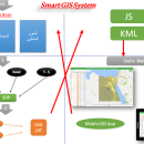
Elshayal Smart 23.02 freeware
Download Maps from Google Earth, and Trace & save ... Raster Images gif, jpg, bmp and Edit shape files, build new layer, add existing layer, remove layers, swap layers, save layer, set layer data source, layer properties, zoom in & zoom out, pan, identify, selecting features, invert selection, show data table, data query builder, location query builder, build network. ...
| Author | Elshayal Smart Web On Line Software |
| Released | 2023-02-28 |
| Filesize | 6.00 MB |
| Downloads | 562 |
| OS | Windows Vista, Windows Vista x64, Windows 7, Windows 7 x64, Windows 8, Windows 8 x64, Windows 10, Windows 10 x64 |
| Installation | Instal And Uninstall |
| Keywords | edit map, GIS editor, edit GIS, GIS, editor, raster |
| Users' rating (22 rating) |
Elshayal Smart Free Download - we do not host any Elshayal Smart torrent files or links of Elshayal Smart on rapidshare.com, depositfiles.com, megaupload.com etc. All Elshayal Smart download links are direct Elshayal Smart download from publisher site or their selected mirrors.
| 23.02 | Feb 28, 2023 | New Release | |
| 21.02 | Jan 26, 2021 | New Release | |
| 21.01 | Jan 12, 2021 | New Release |


