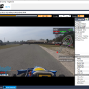
GPX Render 2.07 freeware
GPXRender, telemetry overlay. Extract, analyze, visualize telemetry from GPX. Create dashboard visualizations, gauges. Compatible with gopro, garmin, dji and many more. Visualize Laps and Sectors. Compare times with this race analysis tool. Show and compare your trajectories on the map. The gauges & visuals are customizable, allowing you to resize, change properties, colors and move the elements on the screen. ...
| Author | Keerby Application |
| Released | 2025-03-10 |
| Filesize | 69.27 MB |
| Downloads | 373 |
| OS | Win2000, Windows XP, Windows 7 x32, Windows 7 x64, Windows 8, Windows 10, WinServer, WinOther, Windows 2000, Windows 2003, Windows Server 2000, Windows Server 2003, Windows Server 2008, Windows Server 2008r2, Windows Server 2012, Windows Tablet PC Edition 2005, Windows Media Center Editi |
| Installation | Install and Uninstall |
| Keywords | GPXRender, telemetry, gpx, gps, overlay, video, gopro, Extract, analyze, dashboard, gauges |
| Users' rating (21 rating) |
GPX Render Free Download - we do not host any GPX Render torrent files or links of GPX Render on rapidshare.com, depositfiles.com, megaupload.com etc. All GPX Render download links are direct GPX Render download from publisher site or their selected mirrors.
| 2.07 | Mar 10, 2025 | Major Update | |
| 2.06 | Mar 4, 2025 | Major Update | |
| 2.02 | Nov 20, 2024 | Major Update |


