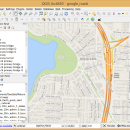
QGIS for Linux 3.36.1 freeware

... geotiff). QGIS supports plugins to do things like display tracks from your GPS.
QGIS aims to be an easy to use GIS, providing common functions and features. The initial goal was to provide a GIS data viewer. ...

Author Gary Sherman
Released 2024-03-26
Filesize 1.00 MB
Downloads 785
OS Linux
Installation Instal And Uninstall
Keywords geographic information system, map creator, map viewer, GIS, geographic information, create, QGIS for Linux
Users' rating
(37 rating)
QGIS for LinuxCADLinux
QGIS for Linux - display system Freeware Download Notice

QGIS for Linux Free Download - we do not host any QGIS for Linux torrent files or links of QGIS for Linux on rapidshare.com, depositfiles.com, megaupload.com etc. All QGIS for Linux download links are direct QGIS for Linux download from publisher site or their selected mirrors.

QGIS for Linux freeware - The Latest User Reviews
QGIS for Linux freeware - The Latest Versions History
3.36.1 Mar 26, 2024 New Release
3.36.2 Apr 25, 2024 New Release
3.36.1 Mar 26, 2024 New Release

Most popular CAD freeware downloads

Jmol for Linux

14.31.53 freeware download

... an applet and Java based application designed to display various 3D chemical information. Jmol's features include ... Automatically adopts the language of the user's operating system, if it is among the translations available. You ...

Jmol

14.31.53 freeware download

... an applet and Java based application designed to display various 3D chemical information. Jmol's features include ... Automatically adopts the language of the user's operating system, if it is among the translations available. You ...

TinyCAD

3.00.04 freeware download

... Web & Word Creating Circuit Diagrams for display on the Web and in Word TinyCAD ... of GIFs. All modern web browsers and operating systems support PNG files. You can create PNG ...

CMISS

3.0.0 freeware download

... including a graphical front end with advanced 3D display and modelling capabilities, and a computational backend that may be run remotely on powerful workstations or ...

TNTmips

20240404 freeware download

TNTmips software is a complete Geographic Information System (GIS) that lets you work with virtually any ... data types and a multitude of Coordinate Reference Systems. Include layers in a wide variety of external ...

NetLogo

6.0.4 freeware download

... data from multiple parallel runs of a model System Dynamics Modeler NetLogo 3D for modeling 3D worlds ... allows doing batch runs from the command line Display and visualization: Line, bar, and scatter plots Speed ...

QGIS

3.36.1 freeware download

... geotiff). QGIS supports plugins to do things like display tracks from your GPS. QGIS aims to ... layers · Map composer · Identify features · Display attribute table · Select features · Label features ...

QGIS for Linux

3.36.1 freeware download

... geotiff). QGIS supports plugins to do things like display tracks from your GPS. QGIS aims to ... layers · Map composer · Identify features · Display attribute table · Select features · Label features ...

GeoMapApp

3.7.1 freeware download

... climatology, and more. GeoMapApp provides data layering, display customization and analytical tools to support the analysis ... maintained as part of the Marine Geoscience Data System (MGDS) at Lamont-Doherty Earth Observatory of Columbia University. ...

DX Central

2.20 freeware download

... that is concise and easy to use. Information displayed is from NASA, NIST, I Torsomo Objservatory Norway, ... [AIA, EVE, and/or AIA] consortium. A basic help system has been provided from the menu or by ...