Engauge Digitizer for Mac OS X 12.0 freeware

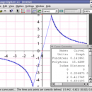
... The image file can come from a scanner, digital camera or screenshot. The numbers can be read on the screen, and written or copied to a spreadsheet.

The process starts with an image file containing a graph or map. The final result is digitized data that can be used by other tools such as Microsoft Excel. ...

Author Mark Mitchell
Released 2019-08-19
Filesize 10.10 MB
Downloads 880
OS Mac OS X
Installation Instal And Uninstall
Keywords digitize image, image to number, process image, digitize, convert, digitizer
Users' rating
(17 rating)
Engauge Digitizer for Mac OS XCADMac OS X
Our rating 5 freeware award
Engauge Digitizer for Mac OS X - digital Freeware Download Notice

Engauge Digitizer for Mac OS X Free Download - we do not host any Engauge Digitizer for Mac OS X torrent files or links of Engauge Digitizer for Mac OS X on rapidshare.com, depositfiles.com, megaupload.com etc. All Engauge Digitizer for Mac OS X download links are direct Engauge Digitizer for Mac OS X download from publisher site or their selected mirrors.

Engauge Digitizer for Mac OS X freeware - The Latest User Reviews
Engauge Digitizer for Mac OS X freeware - The Latest Versions History
12.0 Aug 19, 2019 New Release New hourglass and triangle point types (#346)
Fix data export for log scale data when step factor is less than one (#345)
10.4 Oct 11, 2017 New Release Show warning message when grid line maximum is exceed (#244)
CSV export files have double quotes on fields with internal commas (#243)
Status bar shows all of text for right-to-left languages (#240)
5.1 Dec 24, 2012 New Release Fix for broken point matching, and control of the x/theta axis label.

Most popular CAD freeware downloads

QGIS for Mac

3.36.1 freeware download

... and graduated) · Display raster data such as digital elevation models, aerial photography or landsat imagery · Change raster symbology (grayscale, pseudocolor and multiband RGB) ...

Virtual Terrain Project for Windows

1.1 110804 freeware download

... part of the real world in interactive, 3D digital form. This goal will require a synergetic convergence of the fields of CAD, GIS, visual ...

Virtual Terrain Project for Mac OS X and Linux

1.1 110804 freeware download

... part of the real world in interactive, 3D digital form. This goal will require a synergetic convergence of the fields of CAD, GIS, visual ...

WDSolve

1.0.10 Beta freeware download

... differential equations. WDSolve is based on the Wave Digital method, leading to explicit finite difference schemes with superior stability properties. ...

JMARS

3.1.5 freeware download

... * Take multiple datasets (thermal inertia, mineral composition, digital elevations, etc.) and overlay them into a single, registered multilayer image. * Make topographic profiles, extract ...

5 freeware award

VoxelCut

0.4.0 freeware download

Based on voxlap by Ken Silverman, this program shows an empty world in a window, and then lets you call a Python script file called "Run.py" ...

TNTmips

20240404 freeware download

... efficient Surface Fitting, Contouring, and Triangulation operations produce Digital Elevation Model rasters (DEMs), contour lines, and triangulated irregular networks (TINs), respectively ... ...

QGIS for Linux

3.36.1 freeware download

... and graduated) · Display raster data such as digital elevation models, aerial photography or landsat imagery · Change raster symbology (grayscale, pseudocolor and multiband RGB) ...

Qucs

0.0.19 freeware download

Qucs is a circuit simulator with graphical user interface. The software aims to support all kinds of circuit simulation types, e.g. DC, AC, S-parameter, Harmonic Balance ...

DICOMscope

3.5.1 freeware download

... a print server, support for encrypted DICOM communication, digital signatures and structured reporting. DICOMscope is not meant as a competition for commercial DICOM viewers. ...