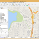
QGIS for Mac 3.36.1 freeware

QGIS supports vector, raster, and database formats and lets you browse and create map data on your computer.
QGIS supports many common spatial data formats (e.g. ESRI ShapeFile, geotiff). QGIS supports plugins to do things like display tracks from your GPS.
QGIS aims to be an easy to use GIS, providing common functions and features. The initial goal was to provide a GIS data viewer. ...

Author Gary Sherman
Released 2024-03-26
Filesize 1600.00 MB
Downloads 750
OS Mac OS X
Installation Instal And Uninstall
Keywords geographic information system, map creator, map viewer, GIS, geographic information, create, QGIS for Mac
Users' rating
(27 rating)
QGIS for MacCADMac OS X
QGIS for Mac - digital editing Freeware Download Notice

QGIS for Mac Free Download - we do not host any QGIS for Mac torrent files or links of QGIS for Mac on rapidshare.com, depositfiles.com, megaupload.com etc. All QGIS for Mac download links are direct QGIS for Mac download from publisher site or their selected mirrors.

QGIS for Mac freeware - The Latest User Reviews
QGIS for Mac freeware - The Latest Versions History
3.36.1 Mar 26, 2024 New Release
3.36.2 Apr 25, 2024 New Release
3.36.1 Mar 26, 2024 New Release

Most popular CAD freeware downloads

Translev

4.16.0 freeware download

... facilitates the process of edtiting, formatting and checking digital leveling observation data and creates abstracts, bok files, ... corrections and plotting. Also included are routines for editing *.lvl files and VERTOBS files. ...

LogicCircuit

2.24.02.27 freeware download

... open source educational software for designing and simulating digital logic circuits. Intuitive graphical user interface, allows you ... clicking items on the diagram you can start editing them. So double click on pin, constant, memory, ...

QGIS

3.36.1 freeware download

... and graduated) · Display raster data such as digital elevation models, aerial photography or landsat imagery · ... overview · Plugins · Improved vector and attribute editing · Improved measure tools with area measuring · ...

QGIS for Mac

3.36.1 freeware download

... and graduated) · Display raster data such as digital elevation models, aerial photography or landsat imagery · ... overview · Plugins · Improved vector and attribute editing · Improved measure tools with area measuring · ...

QGIS for Linux

3.36.1 freeware download

... and graduated) · Display raster data such as digital elevation models, aerial photography or landsat imagery · ... overview · Plugins · Improved vector and attribute editing · Improved measure tools with area measuring · ...

Marvin Suite

20.20.0 freeware download

... has benefited a lot from the development of digital tools. From simple formula recorders to complicated simulators and analyzers, chemists have a wide range of ...

BimRoad

Plus freeware download

... defined connection road. Automatic connection road plan by editing nose point. Automatic correction of road plan design ... & English/Chinese support. Automatic Three-dimensional converting from two-dimensional digital map. Automatic extraction of GIS information in the ...