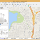
QGIS for Mac 3.36.1 freeware

QGIS supports vector, raster, and database formats and lets you browse and create map data on your computer.
QGIS supports many common spatial data formats (e.g. ESRI ShapeFile, geotiff). QGIS supports plugins to do things like display tracks from your GPS.
QGIS aims to be an easy to use GIS, providing common functions and features. The initial goal was to provide a GIS data viewer. ...

Author Gary Sherman
Released 2024-03-26
Filesize 1600.00 MB
Downloads 755
OS Mac OS X
Installation Instal And Uninstall
Keywords geographic information system, map creator, map viewer, GIS, geographic information, create, QGIS for Mac
Users' rating
(28 rating)
QGIS for MacCADMac OS X
QGIS for Mac - database tool Freeware Download Notice

QGIS for Mac Free Download - we do not host any QGIS for Mac torrent files or links of QGIS for Mac on rapidshare.com, depositfiles.com, megaupload.com etc. All QGIS for Mac download links are direct QGIS for Mac download from publisher site or their selected mirrors.

QGIS for Mac freeware - The Latest User Reviews
QGIS for Mac freeware - The Latest Versions History
3.36.1 Mar 26, 2024 New Release
3.36.2 Apr 25, 2024 New Release
3.36.1 Mar 26, 2024 New Release

Most popular CAD freeware downloads

QGIS for Linux

3.36.1 freeware download

... Software (FOSS). QGIS supports vector, raster, and database formats and lets you browse and create map ... Improved vector and attribute editing · Improved measure tools with area measuring · Attribute searching · New ...

TNTmips

20240404 freeware download

... imagery, terrain surfaces, and map data with associated database attributes. It provides all the tools you need to view, create, edit, georeference, interpret, ... type of geospatial data. TNTmips provides professional geospatial tools in a single package at an affordable price ...

TNTatlas for Mac OS X

2024 B20240508 freeware download

... rapidly assemble and distribute existing electronic map and database materials for those working in natural disaster relief, ... TNTatlas, from MicroImages, Inc. is the free publication tool that lets you organize, distribute, and present the ...

TNTatlas

2024 B20240606 freeware download

... rapidly assemble and distribute existing electronic map and database materials for those working in natural disaster relief, ... TNTatlas, from MicroImages, Inc. is the free publication tool that lets you organize, distribute, and present the ...

Graph construction program

3.2.0 freeware download

... values of certain time period queried from Access database. ...

QGIS

3.36.1 freeware download

... Software (FOSS). QGIS supports vector, raster, and database formats and lets you browse and create map ... Improved vector and attribute editing · Improved measure tools with area measuring · Attribute searching · New ...

Open3DALIGN for Linux

2.28 freeware download

... at unsupervised molecular alignment. Open3DALIGN is a command-line tool which is operated by means of a few ... the single conformation originally imported or the conformational databases previously obtained by QMD. Additionally, SDF conformational databases ...

QGIS for Mac

3.36.1 freeware download

... Software (FOSS). QGIS supports vector, raster, and database formats and lets you browse and create map ... Improved vector and attribute editing · Improved measure tools with area measuring · Attribute searching · New ...

EQAlign

2.3.7 freeware download

... plan a journal, selecting any object of the database, make your own object comment annotations, etc. Supports many cams as long exposure modified webcams, ...

Rocket Propulsion Analysis Lite

1.2.9 freeware download

... Analysis (RPA) is a multi-platform rocket engine analysis tool for rocketry professionals, scientists, students and amateurs. ... Edition, software.lpre.de offers the modern rocket engines analysis tool and promises continuous further development of the program. ...