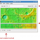
JMARS for Windows 3.1.5 freeware

... Space Flight Facility to provide mission planning and data-analysis tools to NASA's orbiters, instrument team members, students of all ages, and the general public. ...

Author Arizona State University
Released 2014-08-12
Filesize 50.00 MB
Downloads 552
OS Windows Vista, Windows Vista x64, Windows 7, Windows 7 x64
Installation Instal And Uninstall
Keywords mission analysis, geospatial information, GIS analysis, mission, analysis, GIS
Users' rating
(16 rating)
JMARS for WindowsCADWindows Vista, Windows Vista x64, Windows 7, Windows 7 x64
JMARS for Windows - data table Freeware Download Notice

JMARS for Windows Free Download - we do not host any JMARS for Windows torrent files or links of JMARS for Windows on rapidshare.com, depositfiles.com, megaupload.com etc. All JMARS for Windows download links are direct JMARS for Windows download from publisher site or their selected mirrors.

JMARS for Windows freeware - The Latest User Reviews
JMARS for Windows freeware - The Latest Versions History
3.1.5 Aug 12, 2014 New Release - In JMARS, locate the "Options" tab at the top of the screen, click it
- Click "Check for Updates"
3.0.4 Jun 7, 2013 New Release - minor change that will allow users to use Body->reset layers to reset layers to JMARS default/startup state
- minor bug fix in the interaction of the Main view and Panner views
- accuracy of crater layer settings improved when saving crater layers as part of a saved session
- more graceful error handling when loading a saved session
- removed the ESRI option from the list for loading/saving in the shape layer. The Geo tools ESRI option is the replacement
- a fix for a drawing issue in the TES layer on Mac OS X running Java 7
- lower right corner coordinates added to the high resolution export tool including new UI functionality for setting export height and width
- update to how image corners (lat/lon) are specified in high resolution export
- added CSV export and look and feel changes to the Investigate tool
- improved communication between the Stamp Layer and backend databases
- Add Layer UI look and feel improvements
- ease of use changes to crater counting layer for small bodies

Most popular CAD freeware downloads

Panoply for Mac

5.4.3 freeware download

... plots geo-gridded arrays from netCDF, HDF and GRIB datasets. Panoply is designed to help you view and process the data included in netCDF, HDF, GRIB, and other types ...

Gephi for Linux

0.10.1 freeware download

... explore and understand graphs. Like Photoshop but for data, the user interacts with the representation, manipulate the ... reveal hidden properties. The goal is to help data analysts to make hypothesis, intuitively discover patterns, isolate ...

tinyFLP

1.30 freeware download

... for automatic peak selection and scoring of AFLP data tables witten by Wolfgang Arthofer, University of Innsbruck. Austria. ...

Thuban for Mac OS X

1.0.1-3 freeware download

Thuban is an interactive geographic data viewer (GIS viewer) which features methods to visualize, ... geographic information. Thuban is an Interactive Geographic Data Viewer with the following features: # Vector ...

JMARS

3.1.5 freeware download

... Space Flight Facility to provide mission planning and data-analysis tools to NASA's orbiters, instrument team members, students ... to more than a terabyte of NASA orbiter data, and has basic image and vector processing features ...

5 freeware award

QGIS

3.36.1 freeware download

... Software (FOSS). QGIS supports vector, raster, and database formats and lets you browse and create map data on your computer. QGIS supports many common ...

QGIS for Linux

3.36.1 freeware download

... Software (FOSS). QGIS supports vector, raster, and database formats and lets you browse and create map data on your computer. QGIS supports many common ...

Gephi

0.10.1 freeware download

... explore and understand graphs. Like Photoshop but for data, the user interacts with the representation, manipulate the ... reveal hidden properties. The goal is to help data analysts to make hypothesis, intuitively discover patterns, isolate ...

p3d

2.6.2 freeware download

p3d is a general data-reduction tool that is intended to be used with data of fiber-fed integral field spectrographs (IFSs). This tool ... useful for people who have access to astronomical data of such an instrument. Data-reduction tasks, which are ...

Thuban for Windows

1.2.2 freeware download

Thuban is an interactive geographic data viewer (GIS viewer) which features methods to visualize, ... geographic information. Thuban is an Interactive Geographic Data Viewer with the following features: # Vector ...