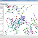
Gephi 0.10.1 freeware

... explore and understand graphs. Like Photoshop but for data, the user interacts with the representation, manipulate the ... reveal hidden properties. The goal is to help data analysts to make hypothesis, intuitively discover patterns, isolate structure singularities or faults during data sourcing. ...

Author Mathieu Bastian
Released 2023-01-17
Filesize 120.00 MB
Downloads 1055
OS Windows XP, Windows Vista, Windows Vista x64, Windows 7, Windows 7 x64, Windows 8, Windows 8 x64, Windows 10, Windows 10 x64, Windows 11
Installation Instal And Uninstall
Keywords interactive visualization, exploration platform, visualization platform, visualization, exploration, graph
Users' rating
(27 rating)
GephiCADWindows XP, Windows Vista, Windows Vista x64, Windows 7, Windows 7 x64, Windows 8, Windows 8 x64, Windows 10, Windows 10 x64, Windows 11
Gephi - data table Freeware Download Notice

Gephi Free Download - we do not host any Gephi torrent files or links of Gephi on rapidshare.com, depositfiles.com, megaupload.com etc. All Gephi download links are direct Gephi download from publisher site or their selected mirrors.

Gephi freeware - The Latest User Reviews
Gephi freeware - The Latest Versions History
0.10.1 Jan 17, 2023 New Release Bugfixes:
Problem when saving (0.10.0)
Infinite loop when opening project
0.9.2 Sep 26, 2017 New Release New features highlight:
New CSV/Spreadsheet importer migrated to Import API. More user friendly, autodetects imported columns types and data format. Integrated with the rest of file importer formats through import report. Now supports importing excel files.
0.9.1 Jan 25, 2016 New Release New German localization

Most popular CAD freeware downloads

Panoply for Mac

5.4.3 freeware download

... plots geo-gridded arrays from netCDF, HDF and GRIB datasets. Panoply is designed to help you view and process the data included in netCDF, HDF, GRIB, and other types ...

Gephi for Linux

0.10.1 freeware download

... explore and understand graphs. Like Photoshop but for data, the user interacts with the representation, manipulate the ... reveal hidden properties. The goal is to help data analysts to make hypothesis, intuitively discover patterns, isolate ...

tinyFLP

1.30 freeware download

... for automatic peak selection and scoring of AFLP data tables witten by Wolfgang Arthofer, University of Innsbruck. Austria. ...

Thuban for Mac OS X

1.0.1-3 freeware download

Thuban is an interactive geographic data viewer (GIS viewer) which features methods to visualize, ... geographic information. Thuban is an Interactive Geographic Data Viewer with the following features: # Vector ...

JMARS

3.1.5 freeware download

... Space Flight Facility to provide mission planning and data-analysis tools to NASA's orbiters, instrument team members, students ... to more than a terabyte of NASA orbiter data, and has basic image and vector processing features ...

5 freeware award

QGIS

3.36.1 freeware download

... Software (FOSS). QGIS supports vector, raster, and database formats and lets you browse and create map data on your computer. QGIS supports many common ...

QGIS for Linux

3.36.1 freeware download

... Software (FOSS). QGIS supports vector, raster, and database formats and lets you browse and create map data on your computer. QGIS supports many common ...

Gephi

0.10.1 freeware download

... explore and understand graphs. Like Photoshop but for data, the user interacts with the representation, manipulate the ... reveal hidden properties. The goal is to help data analysts to make hypothesis, intuitively discover patterns, isolate ...

p3d

2.6.2 freeware download

p3d is a general data-reduction tool that is intended to be used with data of fiber-fed integral field spectrographs (IFSs). This tool ... useful for people who have access to astronomical data of such an instrument. Data-reduction tasks, which are ...

Thuban for Windows

1.2.2 freeware download

Thuban is an interactive geographic data viewer (GIS viewer) which features methods to visualize, ... geographic information. Thuban is an Interactive Geographic Data Viewer with the following features: # Vector ...