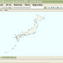
wxGIS Portable 0.4.1 freeware

... has an Explorer-like interface that is able to store the geographic coordinate systems in folders. It also ... utility and a tool for correcting the orthographic data from raster TIFF files. ...

Author Dmitry Barishnikov
Released 2012-11-15
Filesize 9.70 MB
Downloads 342
OS Windows XP, Windows Vista, Windows Vista x64, Windows 7, Windows 7 x64
Installation Instal And Uninstall
Keywords GIS catalog, manage geography data, geographic coordinate system, manage, catalog, geography
Users' rating
(5 rating)
wxGIS PortableCADWindows XP, Windows Vista, Windows Vista x64, Windows 7, Windows 7 x64
wxGIS Portable - data store Freeware Download Notice

wxGIS Portable Free Download - we do not host any wxGIS Portable torrent files or links of wxGIS Portable on rapidshare.com, depositfiles.com, megaupload.com etc. All wxGIS Portable download links are direct wxGIS Portable download from publisher site or their selected mirrors.

wxGIS Portable freeware - The Latest User Reviews
wxGIS Portable freeware - The Latest Versions History
0.4.1 Nov 15, 2012 New Release · The DEM interpolation switch (bilinear or cubic) in orthocorrect tool
· Russian interface translation
· Rename item support
· Automatic rename output files in batch export
· The ortho-correction tool become more accurate and speedy

Most popular CAD freeware downloads

OpenBabelGUI

2.4.1 freeware download

... designed to speak the many languages of chemical data. It's an open, collaborative project allowing anyone to search, convert, analyze, or store data from molecular modeling, chemistry, biochemistry, or related ...

Prode Valves

1.08 freeware download

... evaluation of valve's performance. * Connect to multiple databases to store and retrieve data, search data by different keywords and patterns, easily navigate between ... with items protected by passwords. * Easily define, store and retrieve multiple configurations including language, database connecions, ...

ChannelStorage

1.0.0.0 freeware download

ChannelStorage is a lightweight application that allows you to generate a rating file with the parameters of the depth-flow-storage for a trapezoid channel. These files ...

wxGIS

0.2.0 freeware download

... has an Explorer-like interface that is able to store the geographic coordinate systems in folders. It also ... utility and a tool for correcting the orthographic data from raster TIFF files. ...

wxGIS Portable

0.4.1 freeware download

... has an Explorer-like interface that is able to store the geographic coordinate systems in folders. It also ... utility and a tool for correcting the orthographic data from raster TIFF files. ...