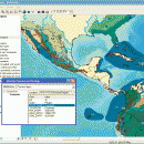
ArcReader 10.5.0 B6491 freeware

... and print maps that are published as Published Map Files (PMF) by the ArcGIS Publisher extension to ArcView, ArcEditor, and ArcInfo. ...

Author ESRI
Released 2017-02-02
Filesize 444.00 MB
Downloads 541
OS Windows XP, Windows Vista, Windows Vista x64, Windows 7, Windows 7 x64, Windows 8, Windows 8 x64
Installation Instal And Uninstall
Keywords view map, print PMF map, export bitmap, view, viewer, map, print
Users' rating
(18 rating)
ArcReaderCADWindows XP, Windows Vista, Windows Vista x64, Windows 7, Windows 7 x64, Windows 8, Windows 8 x64
ArcReader - data on map Freeware Download Notice

ArcReader Free Download - we do not host any ArcReader torrent files or links of ArcReader on rapidshare.com, depositfiles.com, megaupload.com etc. All ArcReader download links are direct ArcReader download from publisher site or their selected mirrors.

ArcReader freeware - The Latest User Reviews
ArcReader freeware - The Latest Versions History
10.5.0 B6491 Feb 2, 2017 New Release
10.4 B5524 Apr 10, 2016 New Release
10.3 B4332 Jan 2, 2015 New Release

Most popular CAD freeware downloads

Panoply for Mac

5.4.3 freeware download

... plots geo-gridded arrays from netCDF, HDF and GRIB datasets. Panoply is designed to help you view and process the data included in netCDF, HDF, GRIB, and other types ...

QGIS for Linux

3.36.1 freeware download

... Software (FOSS). QGIS supports vector, raster, and database formats and lets you browse and create map data on your computer. QGIS supports many common ...

TNTmips

20240404 freeware download

... you work with virtually any type of geospatial data including imagery, terrain surfaces, and map data with associated database attributes. It provides all the tools you need ...

TNTatlas for Mac OS X

2024 B20240508 freeware download

... you publish and distribute your maps and geospatial data — from a single geodata file to complex map layouts prepared using TNTmips. TNTatlas lets you display ...

ExPCB Helper

1.3 freeware download

... a CSV file that has all the location data for pads, traces and filled planes; Automate new component design; Import a small Bit Map (.BMP) file. The file must be 48 pixels ...

TNTatlas

2024 B20240606 freeware download

... you publish and distribute your maps and geospatial data — from a single geodata file to complex map layouts prepared using TNTmips. TNTatlas lets you display ...

JMARS for Windows

3.1.5 freeware download

... Space Flight Facility to provide mission planning and data-analysis tools to NASA's orbiters, instrument team members, students ... to more than a terabyte of NASA orbiter data, and has basic image and vector processing features ...

SoundStepper

5.4.1.304 freeware download

... telescope control, such as for example a sky map, autoguiding, or capture images from a webcam or ... to use the computer's sound hardware, which has data buffers and processing itself, to control step motors ...

JMARS

3.1.5 freeware download

... Space Flight Facility to provide mission planning and data-analysis tools to NASA's orbiters, instrument team members, students ... to more than a terabyte of NASA orbiter data, and has basic image and vector processing features ...

5 freeware award

QGIS

3.36.1 freeware download

... Software (FOSS). QGIS supports vector, raster, and database formats and lets you browse and create map data on your computer. QGIS supports many common ...