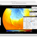
Panoply for Mac 5.4.3 freeware

... user to plot raster image. Depending on the data, it can draw global longitude-latitude images or pole-to-pole ... plots geo-gridded arrays from netCDF, HDF and GRIB datasets. The utility can also combine two arrays and can project the analysis using more than 100 maps. ...

Author Robert B. Schmunk
Released 2024-06-24
Filesize 36.40 MB
Downloads 792
OS Mac OS X
Installation Instal And Uninstall
Keywords plot raster image, longitude image, pole-to-pole image, raster image, rasterize, raster
Users' rating
(29 rating)
Panoply for MacCADMac OS X
Panoply for Mac - data export Freeware Download Notice

Panoply for Mac Free Download - we do not host any Panoply for Mac torrent files or links of Panoply for Mac on rapidshare.com, depositfiles.com, megaupload.com etc. All Panoply for Mac download links are direct Panoply for Mac download from publisher site or their selected mirrors.

Panoply for Mac freeware - The Latest User Reviews
Panoply for Mac freeware - The Latest Versions History
5.4.3 Jun 24, 2024 New Release
5.4.1 Jun 1, 2024 New Release
5.4.0 May 11, 2024 New Release

Most popular CAD freeware downloads

FilterPro Desktop

3.1.0.23446 freeware download

... variations; scale passive component values; and view and export filter performance data to Excel. FilterPro active filter design ... and print professional design reports containing all design data and schematics to help speed time to market. ...

Panoply for Mac

5.4.3 freeware download

... plots geo-gridded arrays from netCDF, HDF and GRIB datasets. Panoply is designed to help you view and process the data included in netCDF, HDF, GRIB, and other types ...

QGIS for Linux

3.36.1 freeware download

... Software (FOSS). QGIS supports vector, raster, and database formats and lets you browse and create map data on your computer. QGIS supports many common ...

QtGrace

0.2.6 freeware download

... offer users a program to display or plot data, analyze data and prepare it for printing. This software is ... automated tasks. FEATURES: · Import numerical data (like scientific measurements, statistics) · Organize and plot ...

MagicPlot Student for Mac OS X

2.9.3 freeware download

... is a handy tool for scientific and engineer data processing, plotting and nonlinear fitting. MagicPlot is powerful ... * Visual nonlinear curve fitting * Vector images export and copying * Automatic formula recalculation on data ...

Thuban for Windows

1.2.2 freeware download

Thuban is an interactive geographic data viewer (GIS viewer) which features methods to visualize, ... geographic information. Thuban is an Interactive Geographic Data Viewer with the following features: # Vector ...

Open Visual Trace Route

1.7.1 freeware download

... Packet sniffer Whois 3D and 2D Map visualisation Export data to image or text Gantt view ...

Engauge Digitizer for Windows

12.0 freeware download

... graph or map. The final result is digitized data that can be used by other tools such ... * You are a graduate student gathering historical data from charts for your thesis. * You are ...

5 freeware award

TNTmips

20240404 freeware download

... you work with virtually any type of geospatial data including imagery, terrain surfaces, and map data with associated database attributes. It provides all the tools you need ...

QGIS

3.36.1 freeware download

... Software (FOSS). QGIS supports vector, raster, and database formats and lets you browse and create map data on your computer. QGIS supports many common ...