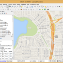
QGIS for Mac 3.36.1 freeware

... and database formats and lets you browse and create map data on your computer.
QGIS supports many common spatial data formats (e.g. ESRI ShapeFile, geotiff). QGIS supports plugins to do things like display tracks from your GPS.
QGIS aims to be an easy to use GIS, providing common functions and features. The initial goal was to provide a GIS data viewer. ...

Author Gary Sherman
Released 2024-03-26
Filesize 1600.00 MB
Downloads 749
OS Mac OS X
Installation Instal And Uninstall
Keywords geographic information system, map creator, map viewer, GIS, geographic information, create, QGIS for Mac
Users' rating
(26 rating)
QGIS for MacCADMac OS X
QGIS for Mac - create table Freeware Download Notice

QGIS for Mac Free Download - we do not host any QGIS for Mac torrent files or links of QGIS for Mac on rapidshare.com, depositfiles.com, megaupload.com etc. All QGIS for Mac download links are direct QGIS for Mac download from publisher site or their selected mirrors.

QGIS for Mac freeware - The Latest User Reviews
QGIS for Mac freeware - The Latest Versions History
3.36.1 Mar 26, 2024 New Release
3.36.2 Apr 25, 2024 New Release
3.36.1 Mar 26, 2024 New Release

Most popular CAD freeware downloads

Panoply for Mac

5.4.3 freeware download

... the generated arrays. You can: Create color contour plots of geo-referenced latitude-longitude, latitude-vertical, longitude-vertical, ... arrays sliced from 2D or larger multidimensional variables. Create color contour plots of "generic" 2D arrays from ...

Gephi for Linux

0.10.1 freeware download

... GEXF file format · Graph streaming ready Create cartography: · Use ranking or partition data to ... interface to filter the network in real-time. · Create complex filter query without scripting · Build new ...

QGIS

3.36.1 freeware download

... and database formats and lets you browse and create map data on your computer. QGIS supports ... "QGIS": · Support for spatially enabled PostgreSQL tables using PostGIS · Support for ESRI shapefiles and ...

QGIS for Linux

3.36.1 freeware download

... and database formats and lets you browse and create map data on your computer. QGIS supports ... "QGIS": · Support for spatially enabled PostgreSQL tables using PostGIS · Support for ESRI shapefiles and ...

tinyFLP

1.30 freeware download

... automatic peak selection and scoring of AFLP data tables witten by Wolfgang Arthofer, University of Innsbruck. Austria. ...

p3d

2.6.2 freeware download

... contains tools to handle the following tasks: Create a master-bias image – any available prescan and ... spectra on the detector; automatically, in most cases. Create a dispersion mask for wavelength calibration. Create a ...

LabQuest Emulator

1.5 freeware download

... software features like graph analysis, built-in labs, periodic table, stopwatch, and more. Explore built-in curriculum including experiments ... of the LabQuest to a class or group. Create screenshot images of the LabQuest software for use ...

SolidFace 3D CAD PTV

24.0.0.X freeware download

... using CSV format (Excel files Association) or TXT table files; Configurable toolbars; Possibility of managing multiple projects ... of parametric variables via commands, questions, or variable tables; Logical conditions If-then-else; Parametric generation of bill of ...

Gephi

0.10.1 freeware download

... GEXF file format · Graph streaming ready Create cartography: · Use ranking or partition data to ... interface to filter the network in real-time. · Create complex filter query without scripting · Build new ...

Gephi for Mac OS X

0.10.1 freeware download

... GEXF file format · Graph streaming ready Create cartography: · Use ranking or partition data to ... interface to filter the network in real-time. · Create complex filter query without scripting · Build new ...