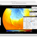
Panoply for Mac 5.4.3 freeware

Panoply for Mac is an utility that enable user to plot raster image. Depending on the data, it can draw global longitude-latitude images or pole-to-pole latitude-vertical images.Panoply is a cross-platform application which plots geo-gridded arrays from netCDF, HDF and GRIB datasets. The utility can also combine two arrays and can project the analysis using more than 100 maps. ...

Author Robert B. Schmunk
Released 2024-06-24
Filesize 36.40 MB
Downloads 875
OS Mac OS X
Installation Instal And Uninstall
Keywords plot raster image, longitude image, pole-to-pole image, raster image, rasterize, raster
Users' rating
(38 rating)
Panoply for MacCADMac OS X
Panoply for Mac - create map Freeware Download Notice

Panoply for Mac Free Download - we do not host any Panoply for Mac torrent files or links of Panoply for Mac on rapidshare.com, depositfiles.com, megaupload.com etc. All Panoply for Mac download links are direct Panoply for Mac download from publisher site or their selected mirrors.

Panoply for Mac freeware - The Latest User Reviews
Panoply for Mac freeware - The Latest Versions History
5.4.3 Jun 24, 2024 New Release
5.4.1 Jun 1, 2024 New Release
5.4.0 May 11, 2024 New Release

Most popular CAD freeware downloads

Panoply for Mac

5.4.3 freeware download

... the generated arrays. You can: Create color contour plots of geo-referenced latitude-longitude, latitude-vertical, longitude-vertical, ... arrays sliced from 2D or larger multidimensional variables. Create color contour plots of "generic" 2D arrays from ...

TrueSpace

7.61 freeware download

... this release, making it easy for you to create your 3D objects and scenes. · The ... real-time engine drives our shared spaces, letting you create immersive online environments with a realism unrivalled in ...

MagicPlot Student

2.9.3 freeware download

... - Data processing - Multiple axes - Color map plots - Figure templates - Batch processing ...

MagicPlot Student for Mac OS X

2.9.3 freeware download

... - Data processing - Multiple axes - Color map plots - Figure templates - Batch processing ...

MagicPlot Student for Linux

2.9.3 freeware download

... - Data processing - Multiple axes - Color map plots - Figure templates - Batch processing ...

Picard

2.27.2 freeware download

Picard comprises Java-based command-line utilities that manipulate SAM files, and a Java API (SAM-JDK) for creating new programs that read and write SAM files. Both SAM ...

QGIS for Mac

3.36.1 freeware download

... and database formats and lets you browse and create map data on your computer. QGIS supports many ... On the fly projection of vector layers · Map composer · Identify features · Display attribute table ...

QGIS for Linux

3.36.1 freeware download

... and database formats and lets you browse and create map data on your computer. QGIS supports many ... On the fly projection of vector layers · Map composer · Identify features · Display attribute table ...

Mobile Atlas Creator

2.2.1 freeware download

... Creator) is an open source (GPL) program which creates offline atlases for GPS handhelds and cell phone ... exported as one large PNG image with calibration MAP file for OziExplorer. As source for an offline ...

Mobile Atlas Creator for Mac OS X

2.2.1 freeware download

... Creator) is an open source (GPL) program which creates offline atlases for GPS handhelds and cell phone ... exported as one large PNG image with calibration MAP file for OziExplorer. As source for an offline ...