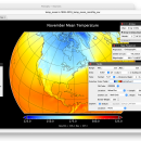
Panoply for Mac 5.4.3 freeware

... an utility that enable user to plot raster image. Depending on the data, it can draw global longitude-latitude images or pole-to-pole latitude-vertical images.Panoply is a cross-platform application which plots geo-gridded arrays from netCDF, HDF and GRIB datasets. The utility can also combine two arrays and can project the analysis using more than 100 maps. ...

Author Robert B. Schmunk
Released 2024-06-24
Filesize 36.40 MB
Downloads 782
OS Mac OS X
Installation Instal And Uninstall
Keywords plot raster image, longitude image, pole-to-pole image, raster image, rasterize, raster
Users' rating
(29 rating)
Panoply for MacCADMac OS X
Panoply for Mac - create image Freeware Download Notice

Panoply for Mac Free Download - we do not host any Panoply for Mac torrent files or links of Panoply for Mac on rapidshare.com, depositfiles.com, megaupload.com etc. All Panoply for Mac download links are direct Panoply for Mac download from publisher site or their selected mirrors.

Panoply for Mac freeware - The Latest User Reviews
Panoply for Mac freeware - The Latest Versions History
5.4.3 Jun 24, 2024 New Release
5.4.1 Jun 1, 2024 New Release
5.4.0 May 11, 2024 New Release

Most popular CAD freeware downloads

Panoply for Mac

5.4.3 freeware download

... the generated arrays. You can: Create color contour plots of geo-referenced latitude-longitude, latitude-vertical, longitude-vertical, ... arrays sliced from 2D or larger multidimensional variables. Create color contour plots of "generic" 2D arrays from ...

DWSIM

6.6.2 freeware download

... clipboard and pasted in other programs as and image. It features automatic error detection, customizable parameters for ... generating distillation curves petroleum characterizations and helps you create new compounds that can be used in experiments, ...

TNTmips

20240404 freeware download

... with virtually any type of geospatial data including imagery, terrain surfaces, and map data with associated database ... provides all the tools you need to view, create, edit, georeference, interpret, and publish any type of ...

MagicPlot Student for Mac OS X

2.9.3 freeware download

... scaling * Visual nonlinear curve fitting * Vector images export and copying * Automatic formula recalculation on ... only. What is disabled here? - Vector image export - Custom fit equations - Data processing ...

pCon.planner

8.9.0.100 freeware download

... cost-free application allowing you to comfortably and professionally create complex furnishing concepts and to visualize them in ... Optimal handling of data - Realistic, on-demand product images with OSPRay - Sharing of pCon.planner panoramas directly ...

Spirograph

1.0.2.1 freeware download

... in the physical toy. Features: · Create spirograph patterns (and a few more not possible using the real toy) · See image creation as animation · Export the created patterns ...

PotterDraw

1.0.02.000 freeware download

... oscillators, and the modulations can be animated to create shape-morphing videos. The texture can be synthesized from ... color palette using various patterns, or a user-specified image file can be texture-mapped via trigonometric functions. Export ...

TNTmips for Mac OS X

20240111 freeware download

... with virtually any type of geospatial data including imagery, terrain surfaces, and map data with associated database ... provides all the tools you need to view, create, edit, georeference, interpret, and publish any type of ...

Br3D

1.3 freeware download

... layer, line type options Save As Save As Image Saves current view as image Object snap Annotation Coordinates Distance Memo Measure Measure ... Text, Polyline, Spline, Insert Model, Insert Block, Insert Image Draw 3D Box, Cylinder, Cone, Torus, Sphere Terrain ...

MagicPlot Student for Linux

2.9.3 freeware download

... scaling * Visual nonlinear curve fitting * Vector images export and copying * Automatic formula recalculation on ... labels What is disabled here? - Vector image export - Custom fit equations - Data processing ...