SDMetrics 2.5 freeware

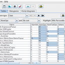
Welcome to SDMetrics - the design measurement tool for the UML. SDMetrics can be used to analyze the structural properties of your UML designs. ...

Author Jürgen Wüst
Released 2021-05-02
Filesize 1.32 MB
Downloads 113
OS Windows XP, Windows Vista, Windows Vista x64, Windows 7, Windows 7 x64, Windows 8, Windows 8 x64, Windows 10, Windows 10 x64
Installation Instal And Uninstall
Keywords analyze structural property, design metrics, establish benchmark, analyzer, analyze, measurement
Users' rating
(13 rating)
SDMetricsCADWindows XP, Windows Vista, Windows Vista x64, Windows 7, Windows 7 x64, Windows 8, Windows 8 x64, Windows 10, Windows 10 x64
SDMetrics - browse file Freeware Download Notice

SDMetrics Free Download - we do not host any SDMetrics torrent files or links of SDMetrics on rapidshare.com, depositfiles.com, megaupload.com etc. All SDMetrics download links are direct SDMetrics download from publisher site or their selected mirrors.

SDMetrics freeware - The Latest User Reviews
SDMetrics freeware - The Latest Versions History
2.5 May 2, 2021 New Release New licensing model: the SDMetrics full version is now freely available for the general public
Data export to Excel XLSX Files (more)
Fixed problem with clipped labels on diagrams when using large font sizes

Most popular CAD freeware downloads

TNTatlas for Mac OS X

2024 B20240508 freeware download

... and geospatial data — from a single geodata file to complex map layouts prepared using TNTmips. TNTatlas ... massive sized geodata and will directly display numerous file formats including shapefiles, GeoTIFF, JP2, PNG, MrSID, DXF, ...

QGIS for Linux

3.36.1 freeware download

... vector, raster, and database formats and lets you browse and create map data on your computer. ... formats support by the OGR library · MapInfo files · GRASS integration, including view, edit, and analysis ...

TNTatlas

2024 B20240606 freeware download

... and geospatial data — from a single geodata file to complex map layouts prepared using TNTmips. TNTatlas ... massive sized geodata and will directly display numerous file formats including shapefiles, GeoTIFF, JP2, PNG, MrSID, DXF, ...

QGIS

3.36.1 freeware download

... vector, raster, and database formats and lets you browse and create map data on your computer. ... formats support by the OGR library · MapInfo files · GRASS integration, including view, edit, and analysis ...

QGIS for Mac

3.36.1 freeware download

... vector, raster, and database formats and lets you browse and create map data on your computer. ... formats support by the OGR library · MapInfo files · GRASS integration, including view, edit, and analysis ...

Gephi

0.10.1 freeware download

... component. · Import temporal graph with the GEXF file format · Graph streaming ready Create cartography: ... in workspaces and save their session .gephi project files. · Save/Load project files · Use the Data ...

Gephi for Linux

0.10.1 freeware download

... component. · Import temporal graph with the GEXF file format · Graph streaming ready Create cartography: ... in workspaces and save their session .gephi project files. · Save/Load project files · Use the Data ...

Gephi for Mac OS X

0.10.1 freeware download

... component. · Import temporal graph with the GEXF file format · Graph streaming ready Create cartography: ... in workspaces and save their session .gephi project files. · Save/Load project files · Use the Data ...

SDMetrics

2.5 freeware download

... SDMetrics with reverse engineering tools that produce XMI files from C++, Java, Delphi, or Smalltalk source code, ... you can interactively explore measurement data, identify outliers, browse histograms and Kiviat charts. Command line interface: ...

Online CAD Converter

1.5 freeware download

... safest solution to convert CAD, CGM, HPGL, SVG files. Output file types include PDF, TIFF, JPEG, EMF, CGM, HPGL, ... Online CAD Converter is fast and user-friendly. You browse for your CAD file and then wait for ...