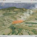
Virtual Terrain Project for Mac OS X and Linux 1.1 110804 freeware

... foster the creation of tools for easily constructing any part of the real world in interactive, 3D digital form.

This goal will require a synergetic convergence of the fields of CAD, GIS, visual simulation, surveying and remote sensing. VTP gathers information and tracks progress in areas such as procedural scene construction, feature extraction, and rendering algorithms. ...

Author Ben Discoe
Released 2011-09-08
Filesize 2.20 MB
Downloads 379
OS Linux, Mac OS X
Installation Instal And Uninstall
Keywords libraries, demos, data, open source, VirtualTerrain Project, CAD, GIS, VTP
Users' rating
(9 rating)
Virtual Terrain Project for Mac OS X and LinuxCADLinux, Mac OS X
Virtual Terrain Project for Mac OS X and Linux - any Freeware Download Notice

Virtual Terrain Project for Mac OS X and Linux Free Download - we do not host any Virtual Terrain Project for Mac OS X and Linux torrent files or links of Virtual Terrain Project for Mac OS X and Linux on rapidshare.com, depositfiles.com, megaupload.com etc. All Virtual Terrain Project for Mac OS X and Linux download links are direct Virtual Terrain Project for Mac OS X and Linux download from publisher site or their selected mirrors.

Virtual Terrain Project for Mac OS X and Linux freeware - The Latest User Reviews
Virtual Terrain Project for Mac OS X and Linux freeware - The Latest Versions History
1.1 110804 Sep 8, 2011 New Release Enviro:
Exposed support for more stereo modes: Horizontal and Vertical split.
Options to enable joystick and spacenavigator, rather than just always using them if present.
Smooth continuous update when making buildings.
Option to constrain building point to right angles. Deter user from making bad points.
Made support for Collada (.dae) more explicit in the UI.
Display the version number in the startup dialog.
Added 'every N meters' option to Contour dialog, making it significantly more useful.
Changed 'Move' mode to use Alt modifier key for up/down, to be consistent.
Fixed issues with: support for elevation grids with non-unit vertical scale; removing layers from a terrain; saving snapshot and high-resolution snapshot; buildings with a Geographic CRS; draping of 2D polylines on terrain with vertical exaggeration.

VTBuilder:
Raw layers: Draw polygon holes as dotted lines to tell them from outer edges.

Most popular CAD freeware downloads

Panoply for Mac

5.4.3 freeware download

... data on a global or regional map using any of over 200 map projections or make a ... outlines or masks on lon-lat map plots. Use any of numerous color tables for the scale colorbar, ...

AutoCAD Mobile

5.5.0.0 freeware download

... apps, Xrefs included. Cloud storage connectivity Access any DWG file in AutoCAD with Autodesk's cloud, as well as with leading cloud storage providers. ...

Freeship Plus

3.43+ freeware download

... If projected the vessel does not correspond to any serial diagram you can take advantage of calculations according to modelling tests of vessels with similar ...

ProfiCAD

12.4.4 freeware download

... drawing low system requirements - runs on any PC with Windows 2000 and higher supports Unicode - can use any language, any technical symbol ships with cca ...

Seq Monk

0.24.1 freeware download

... data but can in theory be used for any dataset which can be expressed as a series of genomic positions. Features: · Import ...

MarvinSketch

23.16.0 freeware download

... attached to atoms, via “S-group” logic so that any user-defined information can be stored directly with the structural information. FEATURES: Chemical structure drawing ...

Digimizer

6.4.0 freeware download

Digimizer is an easy-to-use and flexible image analysis software package that allows precise manual measurements as well as automatic object detection with measurements of object characteristics. ...

ShareCAD

2.0 freeware download

... - open 2D and 3D CAD formats in any browser without installing any additional software; - zoom and rotate images, change ... that will provide access to uploaded drawings from any device connected to the Internet; - add drawing ...

Gmsh

4.13.1 freeware download

... geometry, mesh, solver and post-processing. The specification of any input to these modules is done either interactively using the graphical user interface or in ASCII ...

PreviSat

6.1.0.3 freeware download

... to calculate the passes of artificial satellites for any location on Earth by specifying the start and end date, location, Sun elevation, minimal elevation of ...