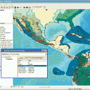
ArcReader 10.5.0 B6491 freeware

ArcReader is a free, easy-to-use desktop mapping application that allows users to view, explore, and print maps and globes. ArcReader is a free and easy-to-use application that allows users to view and print maps that are published as Published Map Files (PMF) by the ArcGIS Publisher extension to ArcView, ArcEditor, and ArcInfo. ...

Author ESRI
Released 2017-02-02
Filesize 444.00 MB
Downloads 542
OS Windows XP, Windows Vista, Windows Vista x64, Windows 7, Windows 7 x64, Windows 8, Windows 8 x64
Installation Instal And Uninstall
Keywords view map, print PMF map, export bitmap, view, viewer, map, print
Users' rating
(18 rating)
ArcReaderCADWindows XP, Windows Vista, Windows Vista x64, Windows 7, Windows 7 x64, Windows 8, Windows 8 x64
ArcReader - any Freeware Download Notice

ArcReader Free Download - we do not host any ArcReader torrent files or links of ArcReader on rapidshare.com, depositfiles.com, megaupload.com etc. All ArcReader download links are direct ArcReader download from publisher site or their selected mirrors.

ArcReader freeware - The Latest User Reviews
ArcReader freeware - The Latest Versions History
10.5.0 B6491 Feb 2, 2017 New Release
10.4 B5524 Apr 10, 2016 New Release
10.3 B4332 Jan 2, 2015 New Release

Most popular CAD freeware downloads

Panoply for Mac

5.4.3 freeware download

... data on a global or regional map using any of over 200 map projections or make a ... outlines or masks on lon-lat map plots. Use any of numerous color tables for the scale colorbar, ...

ProfiCAD

12.4.4 freeware download

... drawing low system requirements - runs on any PC with Windows 2000 and higher supports Unicode - can use any language, any technical symbol ships with cca ...

Gmsh

4.13.1 freeware download

... geometry, mesh, solver and post-processing. The specification of any input to these modules is done either interactively using the graphical user interface or in ASCII ...

MarvinSketch

23.16.0 freeware download

... attached to atoms, via “S-group” logic so that any user-defined information can be stored directly with the structural information. FEATURES: Chemical structure drawing ...

Freeship Plus

3.43+ freeware download

... If projected the vessel does not correspond to any serial diagram you can take advantage of calculations according to modelling tests of vessels with similar ...

PreviSat

6.1.0.3 freeware download

... to calculate the passes of artificial satellites for any location on Earth by specifying the start and end date, location, Sun elevation, minimal elevation of ...

PolyRootsRB for Linux

1.3 freeware download

PolyRootsRB finds the roots of a polynomial to any chosen accuracy using Laguerre's Method. The coefficients of the polynomial can be real or complex. PolyRootsRB ...

SolveDiffEq

3.6.0.0 freeware download

... Using the Runge-Kutta method, SolveDiffEq can solve any number of coupled differential equations of the form ... so as to numerically solve differential equations of any order or to numerically evaluate any one variable ...

TNTmips

20240404 freeware download

... System (GIS) that lets you work with virtually any type of geospatial data including imagery, terrain surfaces, ... to view, create, edit, georeference, interpret, and publish any type of geospatial data. TNTmips provides professional geospatial ...

ShareCAD

2.0 freeware download

... - open 2D and 3D CAD formats in any browser without installing any additional software; - zoom and rotate images, change ... that will provide access to uploaded drawings from any device connected to the Internet; - add drawing ...