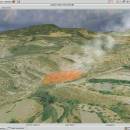
Virtual Terrain Project for Mac OS X and Linux 1.1 110804 freeware

... the fields of CAD, GIS, visual simulation, surveying and remote sensing. VTP gathers information and tracks progress in areas such as procedural scene construction, feature extraction, and rendering algorithms. ...

Author Ben Discoe
Released 2011-09-08
Filesize 2.20 MB
Downloads 388
OS Linux, Mac OS X
Installation Instal And Uninstall
Keywords libraries, demos, data, open source, VirtualTerrain Project, CAD, GIS, VTP
Users' rating
(14 rating)
Virtual Terrain Project for Mac OS X and LinuxCADLinux, Mac OS X
Virtual Terrain Project for Mac OS X and Linux - and Freeware Download Notice

Virtual Terrain Project for Mac OS X and Linux Free Download - we do not host any Virtual Terrain Project for Mac OS X and Linux torrent files or links of Virtual Terrain Project for Mac OS X and Linux on rapidshare.com, depositfiles.com, megaupload.com etc. All Virtual Terrain Project for Mac OS X and Linux download links are direct Virtual Terrain Project for Mac OS X and Linux download from publisher site or their selected mirrors.

Virtual Terrain Project for Mac OS X and Linux freeware - The Latest User Reviews
Virtual Terrain Project for Mac OS X and Linux freeware - The Latest Versions History
1.1 110804 Sep 8, 2011 New Release Enviro:
Exposed support for more stereo modes: Horizontal and Vertical split.
Options to enable joystick and spacenavigator, rather than just always using them if present.
Smooth continuous update when making buildings.
Option to constrain building point to right angles. Deter user from making bad points.
Made support for Collada (.dae) more explicit in the UI.
Display the version number in the startup dialog.
Added 'every N meters' option to Contour dialog, making it significantly more useful.
Changed 'Move' mode to use Alt modifier key for up/down, to be consistent.
Fixed issues with: support for elevation grids with non-unit vertical scale; removing layers from a terrain; saving snapshot and high-resolution snapshot; buildings with a Geographic CRS; draping of 2D polylines on terrain with vertical exaggeration.

VTBuilder:
Raw layers: Draw polygon holes as dotted lines to tell them from outer edges.

Most popular CAD freeware downloads

FilterPro Desktop

3.1.0.23446 freeware download

... v3.1 active filter design software offers a new and improved user interface and a more accurate and robust active filter design engine, thanks to updates, such as ability to adjust passive element tolerances and view response variations; scale passive component values; and ...

Panoply for Mac

5.4.3 freeware download

... application which plots geo-gridded arrays from netCDF, HDF and GRIB datasets. Panoply is designed to help you view and process the data included in netCDF, HDF, GRIB, ...

Model Air Design

1.8 freeware download

... PC. Model Air Design is the new, quick and easy way to create airplane models. It's a ... or old, who has a desire to design and create airplane models but have found Computer Aided ...

Gmsh

4.13.1 freeware download

... generator (primarily Delaunay) with a build-in CAD engine and post-processor. Its design goal is to provide a ... meshing tool for academic problems with parametric input and advanced visualization capabilities. Gmsh is a portable piece ...

ThermoFlo

2.0.9 freeware download

ThermoFlo is a thermal and fluid flow analysis software package with capabilities for solving thermal and flow problems for many different industries and applications. ThermoFlo uses a 1D Systems modeling approach ...

LTplus Google SketchUP DXF

11 freeware download

... Google-3D-Modeller - converts SketchUP.SKP to DXF- or STL-Format and using the LTplus OpenFX 3D-Modeller as well to 3DS/VRML-Format... ...

VirtualBreadboard

6.0.8/1.7.2 freeware download

... prototypes. VBB simulates many of the PIC16 and PIC18 microcontroller devices with a new focus on ... of simulated components such as LCD’s, Servos, logic and other IO devices that can be used to ...

PAST

4.03 freeware download

... analysis, with functions for data manipulation, plotting, univariate and multivariate statistics, ecological analysis, time series and spatial analysis, morphometrics and stratigraphy. PAST is a practical tool designed to ...

ProfiCAD

12.4.4 freeware download

ProfiCAD is the quickest and easiest way to create electrical documentation and schematic diagrams. Although it is very easy to learn and use, it is a professional tool used by ...

MOPlot

1.93 freeware download

... Orbital Plotting Program will prove to be easy-to-use and very efficient. MOPlot can display: · Geometries, ... charges (charges of hydrogens summed into heavy atoms), and atomic spin populations (for open shell systems), if ...