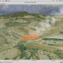
Virtual Terrain Project for Windows 1.1 110804 freeware

... the fields of CAD, GIS, visual simulation, surveying and remote sensing. VTP gathers information and tracks progress in areas such as procedural scene construction, feature extraction, and rendering algorithms. ...

Author Ben Discoe
Released 2011-09-08
Filesize 1.00 MB
Downloads 451
OS Windows 2000, Windows 2003, Windows XP, Windows Vista
Installation Instal And Uninstall
Keywords libraries, demos, data, open source, VirtualTerrain Project, CAD, GIS, VTP
Users' rating
(11 rating)
Virtual Terrain Project for WindowsCADWindows 2000, Windows 2003, Windows XP, Windows Vista
Virtual Terrain Project for Windows - and remote Freeware Download Notice

Virtual Terrain Project for Windows Free Download - we do not host any Virtual Terrain Project for Windows torrent files or links of Virtual Terrain Project for Windows on rapidshare.com, depositfiles.com, megaupload.com etc. All Virtual Terrain Project for Windows download links are direct Virtual Terrain Project for Windows download from publisher site or their selected mirrors.

Virtual Terrain Project for Windows freeware - The Latest User Reviews
Virtual Terrain Project for Windows freeware - The Latest Versions History
1.1 110804 Sep 8, 2011 New Release Enviro:
Exposed support for more stereo modes: Horizontal and Vertical split.
Options to enable joystick and spacenavigator, rather than just always using them if present.
Smooth continuous update when making buildings.
Option to constrain building point to right angles. Deter user from making bad points.
Made support for Collada (.dae) more explicit in the UI.
Display the version number in the startup dialog.
Added 'every N meters' option to Contour dialog, making it significantly more useful.
Changed 'Move' mode to use Alt modifier key for up/down, to be consistent.
Fixed issues with: support for elevation grids with non-unit vertical scale; removing layers from a terrain; saving snapshot and high-resolution snapshot; buildings with a Geographic CRS; draping of 2D polylines on terrain with vertical exaggeration.

VTBuilder:
Raw layers: Draw polygon holes as dotted lines to tell them from outer edges.

Most popular CAD freeware downloads

Panoply for Mac

5.4.3 freeware download

... application which plots geo-gridded arrays from netCDF, HDF and GRIB datasets. Panoply is designed to help you view and process the data included in netCDF, HDF, GRIB, ...

QFitsView

8.6 freeware download

... DS9, developed by Eric Mandel, is a robust and versatile astronomical imaging and data visualization software that has become an indispensable tool for astronomers and astrophysicists worldwide. Designed to handle the complex demands ...

V-REP Player

3.6.2 rev0 freeware download

... general-type robot simulator. It allows you to edit and simulate whole robotic systems, or sub-systems (e.g. sensors, ... functionalities (see hereafter) that can be easily integrated and combined through an exhaustive API and script functionality. ...

JMARS

3.1.5 freeware download

... is an acronym that stands for Java Mission-planning and Analysis for Remote Sensing. It is a geospatial information system (GIS) ... Mars Space Flight Facility to provide mission planning and data-analysis tools to NASA's orbiters, instrument team members, ...

5 freeware award

JMARS for Windows

3.1.5 freeware download

... is an acronym that stands for Java Mission-planning and Analysis for Remote Sensing. It is a geospatial information system (GIS) ... Mars Space Flight Facility to provide mission planning and data-analysis tools to NASA's orbiters, instrument team members, ...

SoundStepper

5.4.1.304 freeware download

... This means using the CPU in dedicated mode, and lose all possibilities of using the computer for ... system, for Windows, the CPU consumption is minimal, and can be used almost all the processing for ...

Prode Valves

1.08 freeware download

Design, sizing, rating and automatic selection of control, safety, relief valves Prode Valves can assist in design, rating and selection of control, safety, relief valves, in addition ...

PyCogent

1.5.3 freeware download

... included with controllers for third-party apps, connectors to remote databases and generalized probabilistic techniques for working with biological sequences. ...

QXRD

0.11.10.16 freeware download

QXRD is software for the acquisition and analysis of X-ray data taken with 2 dimensional ... a Perkin Elmer XRD series flat panel detector and can be remote-controlled via a socket interface, or ...

Virtual Terrain Project for Windows

1.1 110804 freeware download

... the fields of CAD, GIS, visual simulation, surveying and remote sensing. VTP gathers information and tracks progress in areas such as procedural scene construction, feature extraction, and rendering algorithms. VTP writes and supports a set ...