Thuban for Mac OS X 1.0.1-3 freeware

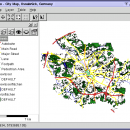
... Support: GeoTIFF Layer and GDAL
# Comfortable Map Navigation
# Object Identification and Annotation
# Legend Editor and Classification
# Table Queries and Joins
# Projection Support
# Printing and Vector Export
# API for Add-Ons (Extensions) ...

Author Thuban Development Team
Released 2009-08-18
Filesize 16.00 MB
Downloads 448
OS Mac OS X
Installation Instal And Uninstall
Keywords geographic data viewer, gis viewer, analyze geographic information, information, geographic, viewer
Users' rating
(13 rating)
Thuban for Mac OS XCADMac OS X
Thuban for Mac OS X - analyze map Freeware Download Notice

Thuban for Mac OS X Free Download - we do not host any Thuban for Mac OS X torrent files or links of Thuban for Mac OS X on rapidshare.com, depositfiles.com, megaupload.com etc. All Thuban for Mac OS X download links are direct Thuban for Mac OS X download from publisher site or their selected mirrors.

Thuban for Mac OS X freeware - The Latest User Reviews
Thuban for Mac OS X freeware - The Latest Versions History
1.0.1-3 Aug 18, 2009 New Release

Most popular CAD freeware downloads

TNTmips for Mac OS X

20240111 freeware download

... of geospatial data including imagery, terrain surfaces, and map data with associated database attributes. It provides all ... published on the Internet as web tilesets, Web Map Service (WMS), and ArcIMS. Automatically generate hundreds ...

UCL Depthmap

0.8.0 freeware download

... aim of the software is to produce a map of open space elements, connect them via some ... Depthmap can be used to derive an ‘axial map’ of a layout. That is, derive a reduced ...

Thuban for Windows

1.2.2 freeware download

... viewer) which features methods to visualize, explore, and analyze geographic information. Thuban is an Interactive Geographic ... Data Support: GeoTIFF Layer and GDAL # Comfortable Map Navigation # Object Identification and Annotation # Legend ...

Thuban for Mac OS X

1.0.1-3 freeware download

... viewer) which features methods to visualize, explore, and analyze geographic information. Thuban is an Interactive Geographic ... Data Support: GeoTIFF Layer and GDAL # Comfortable Map Navigation # Object Identification and Annotation # Legend ...

Thuban for Linux

1.2.2 freeware download

... viewer) which features methods to visualize, explore, and analyze geographic information. Thuban is an Interactive Geographic ... Data Support: GeoTIFF Layer and GDAL # Comfortable Map Navigation # Object Identification and Annotation # Legend ...

GetNexrad

4.4.2 freeware download

... 0.5 dBZ long range higher resolution images. Goggle Map overlays, real-time surface observations, and a web browser sidebar for even more real-time weather info. ...

TNTmips

20240404 freeware download

... of geospatial data including imagery, terrain surfaces, and map data with associated database attributes. It provides all ... published on the Internet as web tilesets, Web Map Service (WMS), and ArcIMS ... Automatically generate ...

CARIS Easy View

4.2.13 freeware download

... a wide range file types, enabling you to analyze raster and vector data saved to numerous formats. ... application that can be used to view and analyze spatial data. It is easy-to-use and includes extensive ...