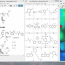
Marvin Suite 20.20.0 freeware

... 3D molecular structure visualization program. It can display all types of macromolecules, including proteins and nucleic acids. ... angle and animations can be run to expose all the bonds. ...

Author ChemAxon Ltd.
Released 2020-11-05
Filesize 129.00 MB
Downloads 338
OS Windows 7, Windows 7 x64, Windows 8, Windows 8 x64, Windows 10, Windows 10 x64
Installation Instal And Uninstall
Keywords Create molecule structure, Molecule structure checker, 3D molecule viewer, Chemistry, Molecule, Structure, Atom
Users' rating
(10 rating)
Marvin SuiteCADWindows 7, Windows 7 x64, Windows 8, Windows 8 x64, Windows 10, Windows 10 x64
Marvin Suite - all formats Freeware Download Notice

Marvin Suite Free Download - we do not host any Marvin Suite torrent files or links of Marvin Suite on rapidshare.com, depositfiles.com, megaupload.com etc. All Marvin Suite download links are direct Marvin Suite download from publisher site or their selected mirrors.

Marvin Suite freeware - The Latest User Reviews
Marvin Suite freeware - The Latest Versions History
20.20.0 Nov 5, 2020 New Release
20.10.0 Apr 8, 2020 New Release Improvements:
Grid visibility is now kept between sessions.
It is now possible to choose between full structure search and substructure search through a dialog box when initiating a Reaxys search.
20.9.0 Feb 10, 2020 New Release Improvements:
Grid visibility is now kept between sessions.
It is now possible to choose between full structure search and substructure search through a dialog box when initiating a Reaxys search.

Most popular CAD freeware downloads

TexGen

3.11.0 freeware download

... you to quickly export the files to various formats including ABAQUS, IGES and STEP. TexGen is ... group. On this website you will find all the information necessary to get started with TexGen ...

QGIS

3.36.1 freeware download

... (FOSS). QGIS supports vector, raster, and database formats and lets you browse and create map data ... computer. QGIS supports many common spatial data formats (e.g. ESRI ShapeFile, geotiff). QGIS supports plugins to ...

QGIS for Linux

3.36.1 freeware download

... (FOSS). QGIS supports vector, raster, and database formats and lets you browse and create map data ... computer. QGIS supports many common spatial data formats (e.g. ESRI ShapeFile, geotiff). QGIS supports plugins to ...

JMARS

3.1.5 freeware download

... to NASA's orbiters, instrument team members, students of all ages, and the general public. JMARS provides ... Moon, for which separate versions now exist. In all its variants, it's free to use and open-sourced, ...

5 freeware award

Pro Yacht

1.0.0.1 freeware download

... the introduction of new realisation code to manage all information extracted from surfaces. While the hull transformation ... introduced covering Tribon/AVEVA Marine, Seasafe and Napa data formats. ...

KMWin

1.52 freeware download

... which are not syntactically correct or filter out all data Preferences Window – Modification of general settings ... previously created plots and saving in different output formats (emf, bmp, jpeg) Log Window – Tracking the ...

VEGA ZZ

3.2.3.28 freeware download

... CPK, ball & stick, stick, trace and tube. All representations can be mixed thanks to the selection ... type of colors. Multiple surface management. All 3D object can be managed with mouse, joystick ...

VariCAD Viewer for Linux

2024 2.01 freeware download

... DWG, DXF, 3D STEP and 2D/3D VariCAD file formats. VariCAD viewer allows you to convert DWG to ... vice-versa, convert STEP to 3D IGES or STL formats, print 2D DWG, DXF or VariCAD formats and ...

JMARS for Windows

3.1.5 freeware download

... to NASA's orbiters, instrument team members, students of all ages, and the general public. JMARS provides ... Moon, for which separate versions now exist. In all its variants, it's free to use and open-sourced, ...

TNTmips

20240404 freeware download

... map data with associated database attributes. It provides all the tools you need to view, create, edit, ... Include layers in a wide variety of external formats without importing. Overlay your geodata on Bing Maps ...