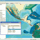
ArcReader 10.5.0 B6491 freeware

... and print maps that are published as Published Map Files (PMF) by the ArcGIS Publisher extension to ArcView, ArcEditor, and ArcInfo. ...

Author ESRI
Released 2017-02-02
Filesize 444.00 MB
Downloads 539
OS Windows XP, Windows Vista, Windows Vista x64, Windows 7, Windows 7 x64, Windows 8, Windows 8 x64
Installation Instal And Uninstall
Keywords view map, print PMF map, export bitmap, view, viewer, map, print
Users' rating
(17 rating)
ArcReaderCADWindows XP, Windows Vista, Windows Vista x64, Windows 7, Windows 7 x64, Windows 8, Windows 8 x64
ArcReader - advanced map Freeware Download Notice

ArcReader Free Download - we do not host any ArcReader torrent files or links of ArcReader on rapidshare.com, depositfiles.com, megaupload.com etc. All ArcReader download links are direct ArcReader download from publisher site or their selected mirrors.

ArcReader freeware - The Latest User Reviews
ArcReader freeware - The Latest Versions History
10.5.0 B6491 Feb 2, 2017 New Release
10.4 B5524 Apr 10, 2016 New Release
10.3 B4332 Jan 2, 2015 New Release

Most popular CAD freeware downloads

Thuban for Windows

1.2.2 freeware download

... Data Support: GeoTIFF Layer and GDAL # Comfortable Map Navigation # Object Identification and Annotation # Legend ... Software components and is itself the basis of advanced GIS applications, e.g GREAT-ER desktop The project ...

Thuban for Linux

1.2.2 freeware download

... Data Support: GeoTIFF Layer and GDAL # Comfortable Map Navigation # Object Identification and Annotation # Legend ... Software components and is itself the basis of advanced GIS applications, e.g GREAT-ER desktop The project ...

ArcReader

10.5.0 B6491 freeware download

... and print maps that are published as Published Map Files (PMF) by the ArcGIS Publisher extension to ... information that was once limited to those with advanced GIS software on their computers. With ArcReader, ...

GeoMapApp

3.7.1 freeware download

GeoMapApp is a map-based application for browsing, visualizing and analyzing a diverse ... Imported table values can be edited and the map symbol, color and size are adjustable. Tabular values ...

Thuban for Mac OS X

1.0.1-3 freeware download

... Data Support: GeoTIFF Layer and GDAL # Comfortable Map Navigation # Object Identification and Annotation # Legend ... Software components and is itself the basis of advanced GIS applications, e.g GREAT-ER desktop The project ...