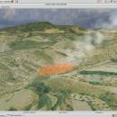
Virtual Terrain Project for Windows 1.1 110804 freeware

... of VTP is to foster the creation of tools for easily constructing any part of the real world in interactive, 3D digital form.

This goal will require a synergetic convergence of the fields of CAD, GIS, visual simulation, surveying and remote sensing. VTP gathers information and tracks progress in areas such as procedural scene construction, feature extraction, and rendering algorithms. ...

Author Ben Discoe
Released 2011-09-08
Filesize 1.00 MB
Downloads 471
OS Windows 2000, Windows 2003, Windows XP, Windows Vista
Installation Instal And Uninstall
Keywords libraries, demos, data, open source, VirtualTerrain Project, CAD, GIS, VTP
Users' rating
(18 rating)
Virtual Terrain Project for WindowsCADWindows 2000, Windows 2003, Windows XP, Windows Vista
Virtual Terrain Project for Windows - 3d tools Freeware Download Notice

Virtual Terrain Project for Windows Free Download - we do not host any Virtual Terrain Project for Windows torrent files or links of Virtual Terrain Project for Windows on rapidshare.com, depositfiles.com, megaupload.com etc. All Virtual Terrain Project for Windows download links are direct Virtual Terrain Project for Windows download from publisher site or their selected mirrors.

Virtual Terrain Project for Windows freeware - The Latest User Reviews
Virtual Terrain Project for Windows freeware - The Latest Versions History
1.1 110804 Sep 8, 2011 New Release Enviro:
Exposed support for more stereo modes: Horizontal and Vertical split.
Options to enable joystick and spacenavigator, rather than just always using them if present.
Smooth continuous update when making buildings.
Option to constrain building point to right angles. Deter user from making bad points.
Made support for Collada (.dae) more explicit in the UI.
Display the version number in the startup dialog.
Added 'every N meters' option to Contour dialog, making it significantly more useful.
Changed 'Move' mode to use Alt modifier key for up/down, to be consistent.
Fixed issues with: support for elevation grids with non-unit vertical scale; removing layers from a terrain; saving snapshot and high-resolution snapshot; buildings with a Geographic CRS; draping of 2D polylines on terrain with vertical exaggeration.

VTBuilder:
Raw layers: Draw polygon holes as dotted lines to tell them from outer edges.

Most popular CAD freeware downloads

DipTrace Free

4.3.0.0 freeware download

... Layout features a shape-based autorouter, high-speed/differential signal routing tools and 3D PCB Preview/Export. Schematic Capture works with ... your design. DipTrace provides manual and automatic placement tools and is capable of routing single- and multilayer ...

GstarCAD MC

3.3.1 freeware download

... •Creating, viewing and editing with with easy-to-use advance tools. • There is no limit to how large ... and use Layout. • Advanced drawing and editing tools such as trim, offset, dimension and find text. ...

Gmsh

4.13.1 freeware download

... mesh. It comes packed with a few handy tools for advanced users. Gmsh is a CAD software that helps you to design 3D elements. ...

MyCadbox

1.0.0.0 freeware download

... a fraction of the time required by conventional tools. Markups added in MyCadbox app are synchronized automatically on PC and iPad for all team members ...

PAST

4.03 freeware download

Past is free software for scientific data analysis, with functions for data manipulation, plotting, univariate and multivariate statistics, ecological analysis, time series and spatial analysis, morphometrics ...

TrueSpace

7.61 freeware download

... use them in Virtual Earth. New Modeling Tools: · The already powerful range of modeling tools in trueSpace is expanded with this release, making ... to tidy up geometry after booleans or imports; tools to optimise triangulation or quadrifying polygons to ensure ...

3D Home Design by Livecad

3.1 freeware download

... standards, whilst benefitting from a range of professional tools to design, display, present and realise all your ... 3D tour - Use a range of advanced tools to modify the land area - Automatic roof ...

ShareCAD

2.0 freeware download

... rotate images, change display modes and use measuring tools; - print drawings; - create temporary links that will allow other users to view uploaded files; ...

VisualCAM

1.0.5.0 freeware download

... dock multiple toolbars inside each other Selection Tools: · Users can select by dragging a window ... (Points, Lines/Polylines, Arcs/Circles, Polycurves, Dimensions, Surfaces) Transformation Tools: · Dynamic Move, Rotate · Array Geometry - ...

Electronic Cancer System Studio

1.0.0.1 freeware download

... of the art in the multi agent simulation tools available for computational modeling of tumorigenesis in a variety of tissues. Features High Definition ...