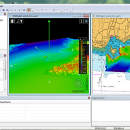
CARIS Easy View 4.2.13 freeware

The program can render the loaded spatial data in a three-dimensional mode, allowing you to view your project from any angle. It is even possible to record videos of your fly-throughs and save them to AVI files. ...

Author CARIS
Released 2015-08-27
Filesize 106.00 MB
Downloads 460
OS Windows XP, Windows Vista, Windows Vista x64, Windows 7, Windows 7 x64, Windows 8, Windows 8 x64, Windows 10, Windows 10 x64
Installation Instal And Uninstall
Keywords View Spatial Data, View Map, Analyze Map, Map, Model, Surface, Geography
Users' rating
(13 rating)
CARIS Easy ViewCADWindows XP, Windows Vista, Windows Vista x64, Windows 7, Windows 7 x64, Windows 8, Windows 8 x64, Windows 10, Windows 10 x64
CARIS Easy View - 3d object Freeware Download Notice

CARIS Easy View Free Download - we do not host any CARIS Easy View torrent files or links of CARIS Easy View on rapidshare.com, depositfiles.com, megaupload.com etc. All CARIS Easy View download links are direct CARIS Easy View download from publisher site or their selected mirrors.

CARIS Easy View freeware - The Latest User Reviews
CARIS Easy View freeware - The Latest Versions History
4.2.13 Aug 27, 2015 New Release Consistent user experience in 2D and 3D
The properties for coverages have been redesigned and apply both in 2D and 3D. A number of new options are presented including the ability to drape high resolution imagery (e.g. backscatter) over elevations in both 2D and 3D views.
Also, a new user interface is provided to investigate the processing lineage of a dataset recorded in the metadata.
Click to return to top of page
Coordinate reference system enhancements
The coordinate reference system (CRS) functionality has been augmented with EPSG CRS and transformations, such as NTv2. The user interface was upgraded with a new look and with additional capabilities. Users can now build a favourites list, see a list of recently used CRS entries, search for new entries and investigate all aspects of the selected reference system or transformation.
Note that if an incorrect CRS has been selected when opening a dataset in the application, it is now possible to change the CRS in the Properties window wh
4.1.11 Aug 27, 2015 New Release Expanded support for commonly used geospatial data formats (e.g. BAG, GeoTIFF, S-57) and web services (WMS, WCS, WMTS, WTMS).
Upgraded support for non-proprietary BAG format to version 1.5.2, which is the latest
version provided by the Open Navigation Surface Working Group.

Most popular CAD freeware downloads

pCon.planner

8.9.0.100 freeware download

... dealers in the furnishing industry. You load the objects directly into your planning and thus equip the ... onto Facebook - Measuring height of any selected object - Support for the drawing element "cylinder" for ...

FieldVIZ

r165 freeware download

FieldVIZ is meant to allow easy visual inspection of electro- and magnetostatic fields in 2D and 3D. ...

SCaVis

2.3 freeware download

... for several Java-native SQL databases (including SQLite) and object-based databases. It complies with the ROOT and AIDA data formats. Finally, it uses several platform-neutral file ...

5 freeware award

Br3D

1.3 freeware download

... Save As Image Saves current view as image Object snap Annotation Coordinates Distance Memo Measure Measure Area ... Wireframe Hidden line Shaded Rendered Script CAD Draws object using script(line, circle, polyline etc) Draw Line, Circle, ...

GstarCAD MC

3.3.1 freeware download

... mobile • Move, Copy, Rotate, Scale, Color, Measure object, record management results, manage layers and use Layout. ... way for users to view details and snap objects. • Precise Drawing available, e.g., user can change ...

VEGA ZZ

3.2.3.28 freeware download

... colors. Multiple surface management. All 3D object can be managed with mouse, joystick and dials (rotation, translation, scale and animation). 3D interactive ...

Techne CAD/CAM

1.0.31.0 RC freeware download

... to AutoCAD. The user specifies machining aspects during object creation so that when the design/layout phase is ... generation can occur automatically. What is 2.5D? Objects created are flat (2D) but have a depth ...

TrueSpace

7.61 freeware download

... wide variety of formats, letting you take existing objects and use them in Virtual Earth. New ... it easy for you to create your 3D objects and scenes. · The improvements include the ...

DAVID-Laserscanner

5.6.0.2037 freeware download

... a laser that projects a line onto the object you want to scan. So everyone can use it to scan objects without high costs; this is the big advantage ...

Techne CAD/CAM x64

1.0.31.0 RC freeware download

... to AutoCAD. The user specifies machining aspects during object creation so that when the design/layout phase is ... generation can occur automatically. What is 2.5D? Objects created are flat (2D) but have a depth ...